Donate to Friends of CAIC by April 1st for a chance to win over $10k of prizes!

Show Your Support!
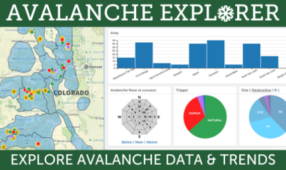
Explore Avalanche Data
Our interactive Avalanche Explorer tool makes it easy to explore avalanche data, spot patterns, and better understand current conditions to stay safe out there.

Weekly Updates & More!
Explore all our blog posts here, including regular summaries and in-depth topical discussions on avalanche safety, forecasting, and backcountry travel.