Avalanche Weekly Summary - February 13, 2025
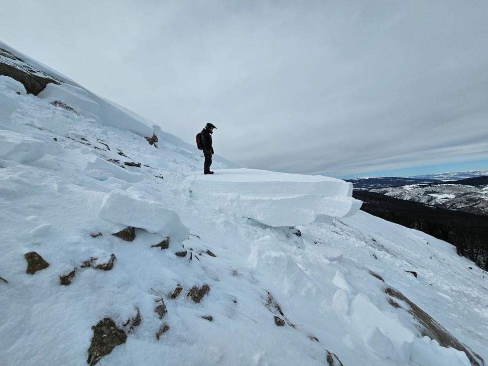
Northern Mountains
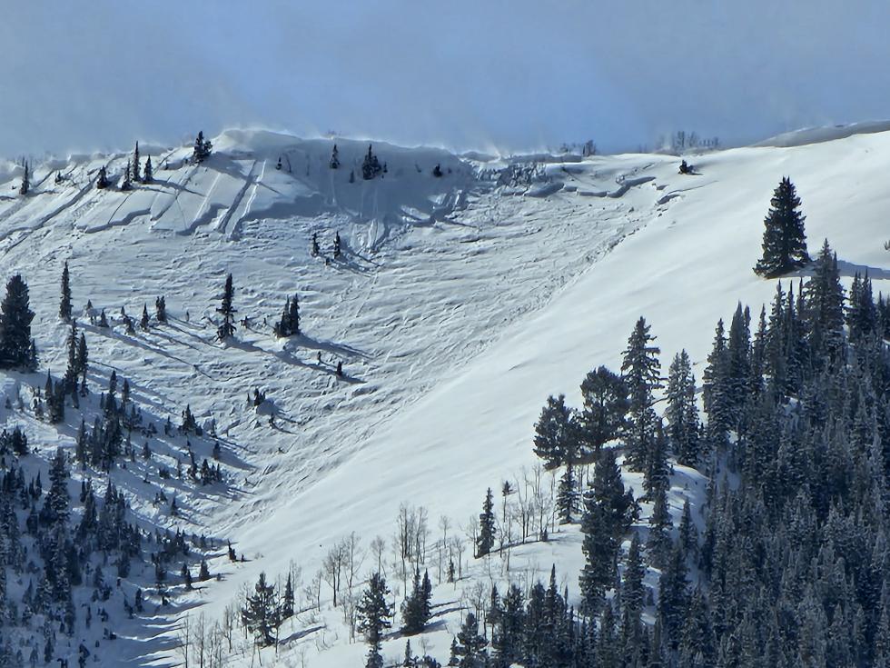
The Northern Mountains received 8 to 16 inches of snow last Friday and Saturday, accompanied by strong westerly winds, followed by a smaller storm on Tuesday. For the first time in weeks, people reported avalanches breaking near the ground—though few in number, it’s an indicator of increasing instability and what’s to come. In the past week, five people were caught in avalanches, marking a notable uptick in avalanche involvements, including a close call involving two CAIC forecasters near Vail Pass.
Central Mountains
The Central Mountains saw the end of a warm spell, followed by 6 to 15 inches of new snow accumulating on firm crusts. Steady westerly winds have drifted snow onto east-facing slopes, creating a complex mix of crusts, facets, and hard slabs across the region. People reported a steady trickle of avalanches after the mid-week storm, including a snowmobile-triggered slide in the southern Sawatch Range.
Southern Mountains
The Southern Mountains remained mostly warm and dry, with only light snowfall earlier in the week, primarily in the San Juan Mountains. That snow has since faceted on the surface, adding to the variable mix of surfaces, which also includes crusts and hard slabs. Avalanche activity has been minimal, with no notable incidents reported.
Heading Into the Weekend
Dangerous avalanche conditions are expected throughout the weekend and will be slow to subside. Snowfall totals across Colorado will be significant, with 1 to 2 feet in the Park Range and Flat Tops, with higher amounts north of Steamboat. The Front Range and Summit County are expected to receive 8 to 12 inches, while the Vail area and Gore Range will see 12 to 16 inches. The Sawatch Range is forecasted to receive 10 to 14 inches, with the highest amounts in the south. The Elk Mountains will see 10 to 20 inches, with over 3 feet in the West Elk Mountains. The Grand Mesa is expected to receive 2 to 3 feet, while the North San Juan Mountains will see 18 to 24 inches. The South San Juan Mountains are forecasted to receive 2 to 3 feet, with higher amounts in the La Plata Mountains and areas south of Wolf Creek Pass. This new snow will create fresh avalanche problems, and with such a heavy load, deeper weak layers will become active again, increasing the risk of large avalanches.
With HIGH (4 of 5) and CONSIDERABLE (3 of 5) avalanche danger across the state this weekend, now is the time to adjust plans, stay informed, and prioritize safety. Slopes that were safe last week–when the snow was cohesionless and weak–will now be dangerous. Safe terrain options will be greatly reduced, and in some areas, avoiding avalanche terrain altogether will be necessary. Simple, low-angle terrain is the best and safest option this weekend. Check the latest avalanche forecast before heading out.