Dec 2023 Summary
Summary
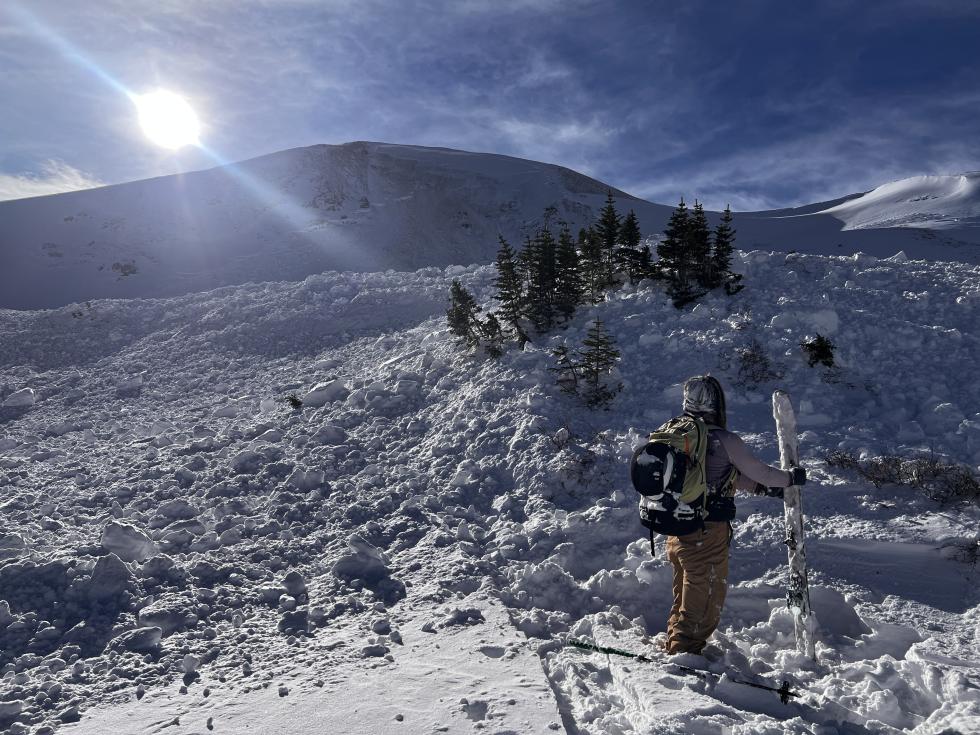
December started with a couple of large, booming storms that created a large avalanche cycle. These storms mostly missed the south until later in the month. Storms were separated by long spells of warm, calm weather with cold nights. A long dry spell at the end of the month brought most mountain ranges to LOW avalanche danger. People reported 602 avalanches, 112 of which were human-triggered. In eight avalanche incidents, 10 people were caught and three were partly buried with no major injuries.
First Days of December
December started with a shallow snowpack, comprised of faceted snow grains from top to bottom. Most areas lacked a cohesive slab required for large avalanches. The deepest snowpack was in the Ragged and Elk Mountains, where SNOTEL sites showed the snowpack was only 80% of the 30-year median. In the rest of Colorado, this number was closer to 50%.
This scene quickly changed as a large storm affected all areas of the state, and we issued the first avalanche warnings of the season on December 3 for the Park Range, Ruby Range, and mountains around Marble. SNOTEL sites showed up to 1.5 inches Snow Water Equivalent (SWE) in the south, two inches in the Central Mountains, and a whopping five inches in the Park Range.
Several Close Calls
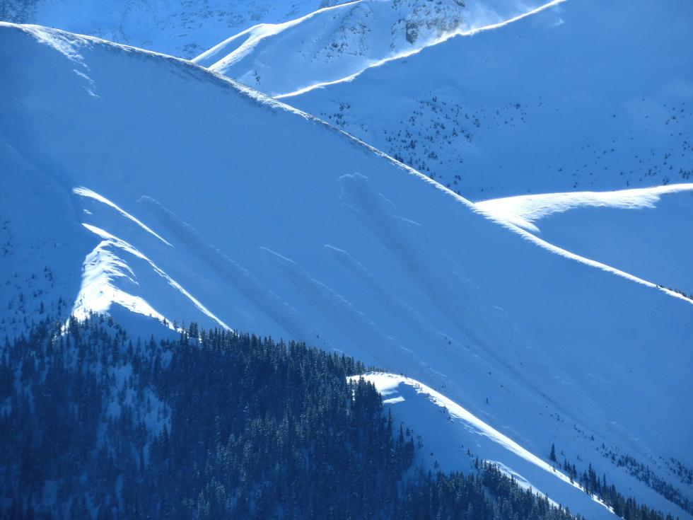
With a big storm falling on such a weak snowpack, the number and size of avalanches spiked. Observers reported 309 avalanches in the first five days of the month; 129 were D2 (large enough to bury or kill a person) or larger. A flurry of close calls occurred during these same five days. A rider near Red Mountain Pass triggered a slide and was buried to his neck; a solo snowboarder was caught and carried close to Marble; two people skinning on Berthoud Pass were carried by an avalanche they remotely triggered from 1000 feet away; and finally a solo rider was caught and dragged through trees in East Vail.
Another Storm and Serious Wind
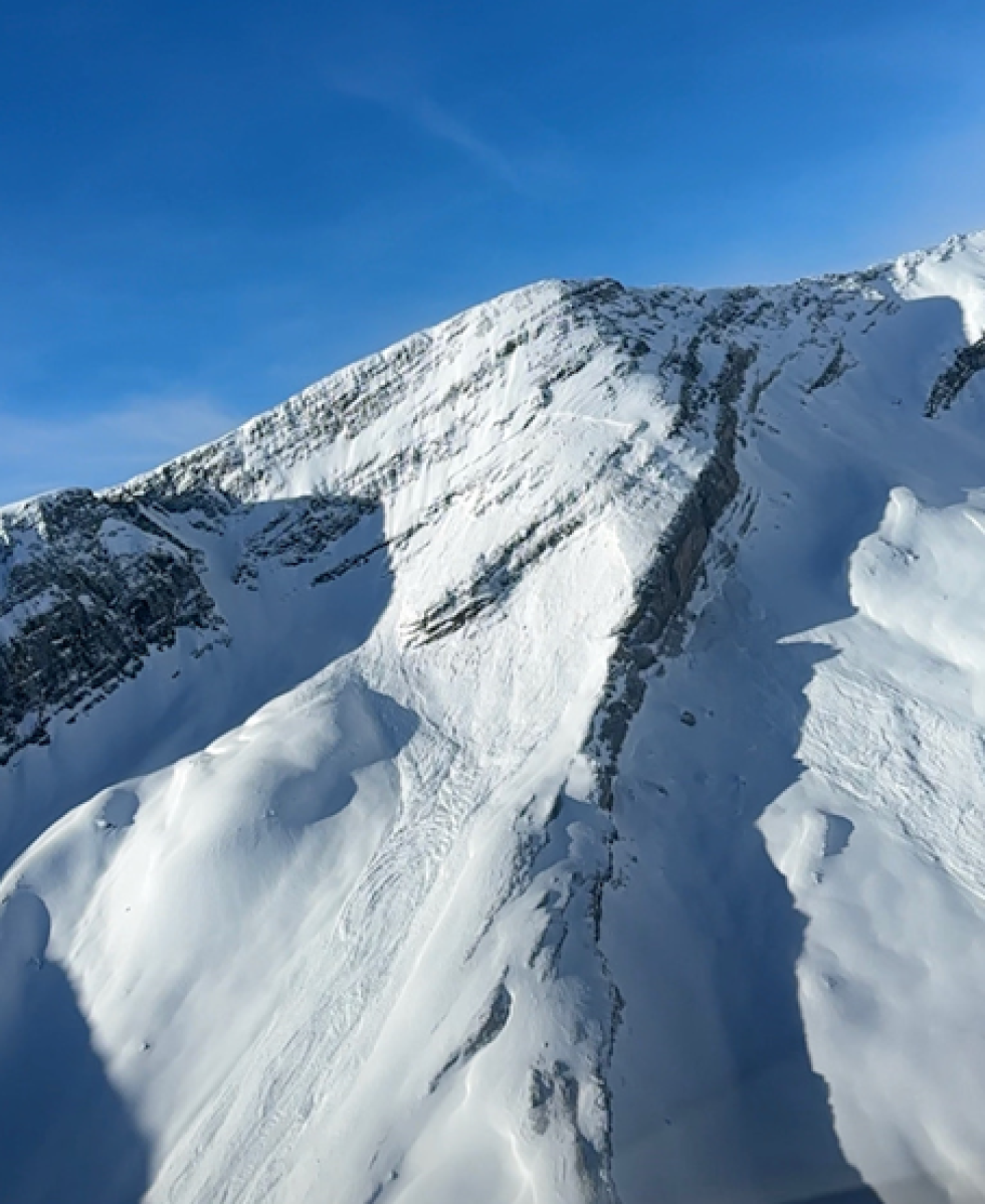
On December 8, another storm impacted Colorado. The Park Range, along I-70, and around the Aspen area reported snow accumulations near 20 inches. The real kicker in this storm was the northwest winds with widespread gusts over 60 mph. The stronger snowpack meant less of an avalanche cycle after this storm, but thicker connected slabs did mean our largest avalanche of the season: a D3 on Treasury Mountain near Crested Butte.
A Warm Mid-December
Attention shifted from basal weak layers to surface conditions because of another long dry spell. Warm weather and cold nights were faceting the surface snow and allowing surface hoar development.
Finally, on December 13, the Southern Mountains got some action with a storm that deposited about one inch of SWE across the south San Juan Mountains and lower totals further north. With enough snow to finally connect the terrain, a flurry of large avalanches occurred.
Throughout December the storm intervals followed a similar pattern: Westerly flow, light winds, and unseasonably warm temperatures. These conditions were in full effect from December 16-22. Observers reported only ten avalanches around Colorado. Slabs were losing strength, resulting in LOW or MODERATE danger everywhere.
Some Snow for the Holidays
Santa gave the Southern Mountains a Christmas Eve gift of one inch of SWE. Keeping things fair among siblings, he gave a similar amount to the Northern Mountains on Christmas morning. The Central Mountains seemed to be on the naughty list, receiving only half an inch. The snow was very light, and on Boxing Day (December 26), strong northwest winds took all the goose feathers, drifting them over crusted southerly and faceted easterly aspects. A round of avalanches on these aspects delayed a charge to the New Year with a green map.
December finished with a dry spell, and most mountains in Colorado crept to LOW avalanche danger. Areas that were still at MODERATE had a chance for a low-likelihood, high-consequence avalanche from a basal problem or because of concern over near-surface facets in the upper snowpack. As 2023 rolled to a close, we are very thankful to have zero fatalities at this point in the season–the first time since the 2018-19 season. Let's all make the New Year's resolution to continue this trend through the rest of the season but also hope for more snow!