Avalanche Weekly Summary - April 10, 2025
Northern Mountains
The last storm in the Northern Mountains ended on Friday, April 4, after a week of unsettled weather that delivered 1 to 2 feet of snow. Since then, conditions have been mostly dry, with temperatures gradually warming each day. Avalanche activity has been minimal, limited to a few small wet avalanches. No large avalanches (D2 or larger) have been reported since March 30. The only notable incident report occurred on Sunday, April 6, when two climbers were caught in a Wind Slab avalanche on St. Mary’s Glacier.
Central Mountains
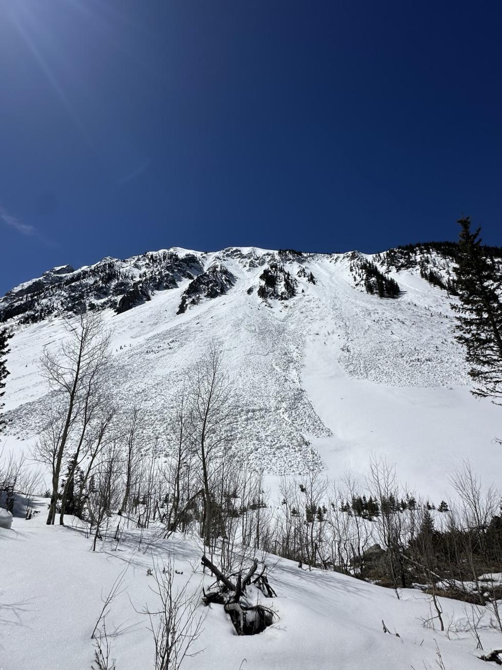
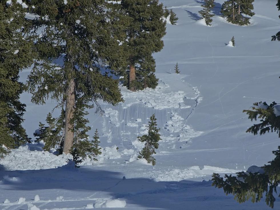
The Central Mountains saw their last storm on April 4, bringing 6 to 12 inches of new snow. Since then, a warming trend has melted snow rapidly on valley floors, while high-elevation north-facing slopes have remained dry. A notable wind event on April 7–8 redistributed snow onto easterly slopes, creating conditions for easily triggered small Wind Slab avalanches. Over the past week, 131 avalanches were reported—mostly small wet avalanches. Just eight D2s were reported last week. Between April 2 and 4, four people were caught in four separate avalanches near Marble and Crested Butte. All of these slides ran on a surprising new crust-facet persistent weak layer.
Southern Mountains
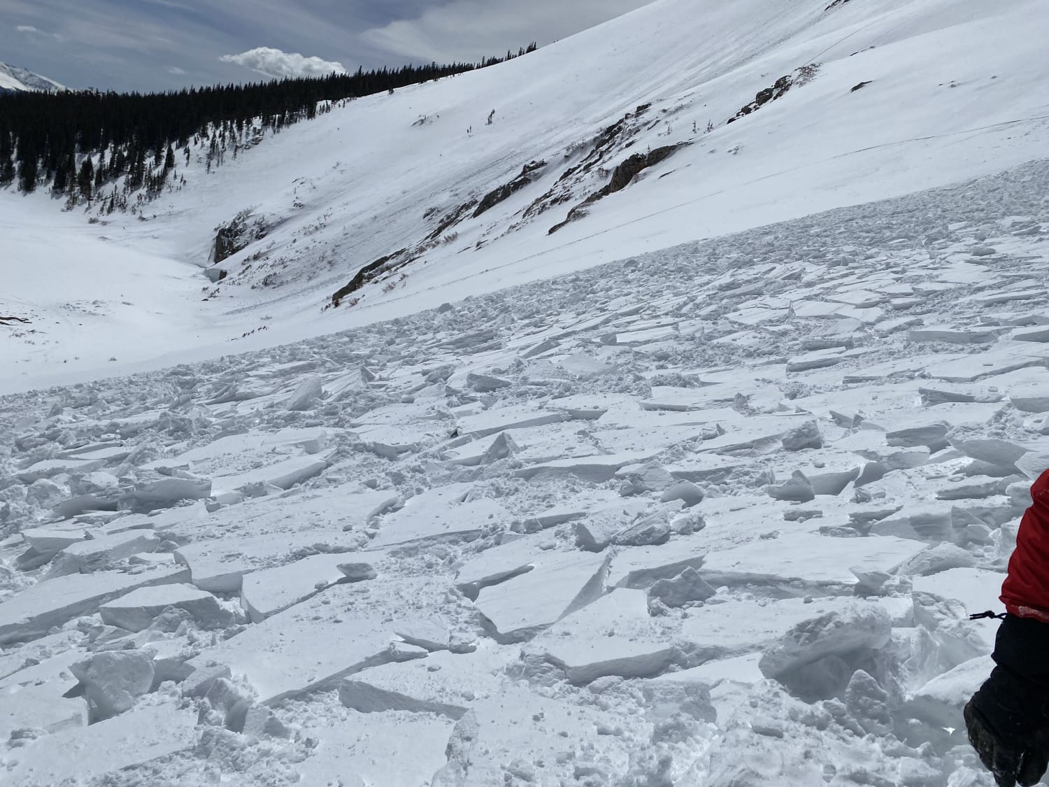
The last storm in the Southern Mountains also wrapped up on Friday, April 4, after delivering 12 to 18 inches of snow across most areas. Since then, conditions have been sunny, dry, and slowly warming. Avalanche activity has been limited, with only 10 (mostly small) avalanches reported in the past week. On Saturday, April 5, a group of seven skiers triggered an avalanche in the Sneffels Range; the fourth skier, who was caught, carried, and partially buried, initiated the slide. A natural avalanche was also observed that day on a hanging cliff face in Paradise Basin - both avalanches highlighting the settlement of the most recent storm snow..
Heading Into the Weekend
Start and finish early to reduce your risk. However, this guidance may be less applicable at lower elevations on Friday and Saturday in areas that don’t see a solid overnight refreeze. As melt-freeze crusts soften, the chance for wet avalanches increases—especially on Saturday, which looks to be the peak for wet activity.