Colorado Avalanche Information Center

Contact
Login / Signup
  • Submit an Observation
  • Join / Donate
  • Forecasts
    • Statewide Avalanche
    • Weather
      • Model Forecasts
      • Point Forecasts
    • Watches and Warnings
    • Radio Recordings
    • Help
      • Social Media
      • Using CAIC Products
      • Forecast Zones
      • Avalanche Danger
      • Avalanche Problems
      • Avalanche Coding
      • Weather Observation Coding
  • Observations
    • Submit Observation
    • Field Reports
    • Avalanche Explorer
    • Backcountry Avalanches
    • Weather Stations
    • Media Gallery
  • Accidents
    • Colorado
    • US
    • Statistics and Reporting
  • Education
    • Education and KBYG Calendar
    • Know Before You Go
      • KBYG Class Request
      • KBYG Instructor Information
    • Know Before You Go to Work
    • CAIC Programs
    • Resources
    • Blog
  • About the CAIC
    • About the CAIC
    • CAIC Staff
    • Annual Reports
    • Event Calendar
    • Site Map
  • Friends of CAIC
    • Join / Donate
      • Join
      • Donate
    • About the Friends of CAIC
    • Ways to Give
    • Events
    • Online Store
    • The Forecast Pledge
    • Friends of CAIC Mobile App
    • Annual Reports
  • Sponsors
  • Google PlusFacebookTwitter
Search results for: deep persistent slab

Persistent Slab

Release of a cohesive layer of soft to hard snow (a slab) in the middle to upper snowpack, when the bond to an underlying persistent weak layer breaks. Persistent layers include: surface hoar, depth hoar, near-surface facets, or faceted snow. Persistent weak layers can continue to produce avalanches for days, weeks or even months, making them especially dangerous and tricky. As additional snow and wind events build a thicker slab on top of the persistent weak layer, this avalanche problem may develop into a Deep Persistent Slab.

The best ways to manage the risk from Persistent Slabs is to make conservative terrain choices. They can be triggered by light loads and weeks after the last storm. The slabs often propagate in surprising and unpredictable ways. This makes this problem difficult to predict and manage and requires a wide safety buffer to handle the uncertainty.

How they form

Persistent Slabs form when a persistent weak layer is buried by additional layers of snow. The problem persists after storm and wind slab instabilities have stabilized. The persistent weak layer can cycle through periods of sensitivity from reactive to nonreactive due to changes in weather conditions such as new precipitation, wind loading, strong solar radiation, and/or rapid changes in air temperature.

persist1
This Persistent Slab was triggered remotely, failed on a layer of faceted snow in the middle of the snowpack, and crossed several terrain features.

Where they are

The spatial distribution of Persistent Slabs is dictated by the distribution of the culprit weak layer. The weak layer distribution is dictated by the weather patterns responsible for its creation. Thus, Persistent Slab distribution can range from widespread across terrain to very specific terrain features. They can occur at all elevations and on all aspects. Persistent Slabs can be triggered remotely, and on low-angle to steep slopes. Consult the backcountry avalanche forecast to determine where in the terrain this problem exists.
persist2
A Persistent Slab avalanche that propagated over several terrain features.

Timing

Persistent Slabs can be a problem during any time of the snowy season. Anytime you have a slab resting over a reactive persistent weak layer, you have a Persistent Slab problem. This problem can develop during the fall and last well into the spring.

Recognition

Persistent Slabs can be distinguished from Storm and Wind Slabs by how the fracture lines fail in the terrain. Unlike storm instabilities, Persistent Slabs are commonly triggered remotely, from flat areas, and failures can propagate across terrain features like ridges, ribs, and gullies. It is possible to have a Persistent Slab problem that is susceptible to human triggering but not produce many spontaneous avalanches. The lack of avalanche activity does not always indicate the absence of a Persistent Slab problem. You can look for persistent weak layers in snow profiles, and perform snowpack tests to gauge sensitivity and distribution of a Persistent Slab problem. Consult the backcountry avalanche forecast to determine where in the terrain this problem exists.

Treatment and Avoidance

Persistent Slabs can be triggered by light loads and weeks after the last storm. They are commonly trigged remotely and they often propagate across and beyond terrain features that would otherwise confine wind and storm slabs. Failures often propagate in surprising and unpredictable ways. This makes this problem difficult to predict and manage and requires a wide safety buffer to handle the uncertainty. Intimate slope-scale knowledge and tracking of culprit persistent weak layers and avalanche activity over space and time will aid in assessing the severity and extent of this problem. The best ways to manage the risk from Persistent Slabs is to make conservative terrain choices.

Avalanche Essentials–Persistent Slab

Storm Slab

Release of a soft cohesive layer (a slab) of new snow that breaks within the storm snow or on the old snow surface. Storm-slab problems typically last between a few hours and few days. Storm-slabs that form over a persistent weak layer (surface hoar, depth hoar, or near-surface facets) may be termed Persistent Slabs or may develop into Persistent Slabs.

You can reduce your risk from Storm Slabs by waiting a day or two after a storm before venturing into steep terrain. Storm slabs are most dangerous on slopes with terrain traps, such as timber, gullies, over cliffs, or terrain features that make it difficult for a rider to escape off the side.

How they form

Storm Slabs form when new snow consolidates over a weaker layer or interface. The weak point can be snow that fell early in the storm or just a poor bond with the old snow surface. Like a chain, it can just be the weakest part of a snow layer that formed in a single storm or prolonged snowy period. Storm Slabs commonly form during periods of light or no wind.

Where they are

Storm Slabs tend to form in sheltered areas where new snow falls with light winds. They can occur on any steep open slope, and are often found on several aspects at the same time.

Timing and Triggering

Storm Slabs tend to have a short life span. They are easiest to trigger during periods of heavy snow and typically stabilize within a day or two after the storm cycle has ended.

Recognition

Storm Slabs can be difficult to recognize since the surface snow is often soft and powdery. With enough cohesion in the new snow, these slabs can propagate shooting cracks and faint collapses at the interface of the new snow and old snow surface. Snowpack tests that load the snow from above (e.g. Compression Test) have limited utility since they often crush through storm slabs and buried weak layers, and do not identify the problem well. Tilt tests, ski cut results on small inconsequential slopes, or natural activity on indicator slopes are often the best clues that a Storm Slab problem exists.

Storm Slab avalanche

A small Storm Slab triggered by a backcountry skier.

Treatment and Avoidance

Storm Slabs are most dangerous when they run into terrain traps such as timber, gullies, over cliffs, or areas difficult for a rider to escape off to the flank. Due to the nature of the soft, low-density slab, riders may not realize that a Storm Slab has failed until well after it is running. It is common to underestimate the extent of propagation with soft Storm Slabs, and resulting avalanches are often larger than expected. You can reduce your risk from Storm Slabs by waiting a day or two after a storm before venturing into steep avalanche terrain. They usually stabilize in less than a week, so you can reduce your risk by waiting several days after a big loading event.

Experienced riders can use slope cuts as a tool to help release a Storm Slab. Under most conditions, good planning will allow a group to recognize terrain traps as well as good escape routes prior to a triggered a Storm Slab. However, Storm Slabs, can trigger avalanches into deeper, old-snow layers. This scenario can lead to a much larger and more dangerous avalanche.

Avalanche Essentials–Storm Slabs

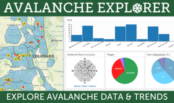
Using the Avalanche Explorer


Avalanche activity often follows patterns where similar avalanches release on similar slopes. You can use the Avalanche Explorer to look for these patterns. Then use the data to help you avoid slopes that could produce a similar avalanche.

You can learn more about avalanche data codes on our Avalanche Coding help page or in Chapter 3 of Snow, Weather, and Avalanches: Observation Guidelines for Avalanche Programs in the United States.

How to use the tool

Filtering
  • Use the dropdown menus at the top of the page to the right of the map
  • Click on the bars and pie pieces of the charts in the right-side panel. Look for the reset link in the upper right on the charts where you’ve set a filter. You’ll see just the filtered records on the map.
  • Use the lasso tool on the map to select an area or group of data points. You’ll see data from just those points in the charts on the right. Click on the X to clear your lasso selection.
  • You can sort the records in the tables by clicking on the column headers

Help
  • Mouseover areas of the charts to see numbers or get some help (don’t mouseover the chart labels)
  • Mouseover labels in the table to get some help

Colors
  • Avalanche Trigger – Map, Pie Chart, Table
    • Red – Avalanches triggered by people – This includes avalanches triggered by skiers, snowboarders, snowmobilers, snowshoers, hikers, and climbers.
    • Blue – Avalanches triggered by explosives – These are slides triggered as part of active avalanche hazard mitigation programs.
    • Green – Avalanches triggered by natural events such as snow and wind storms
    • Purple – Other and Unknown – This includes avalanches triggered by vehicles, wildlife, or if we are not able to determine the cause of the avalanche.
  • Clusters – Map
    • Orange – Shows clusters of avalanches with the same location. Click orange circle to expand the cluster. Click anywhere else on the map to close the cluster.

Video Tutorial

Explorer Elements

Map – The location of each avalanche

Top menus – Filter the data by
  • Date range
  • Observation type
  • Avalanche type

Zone bar chart – The number of avalanches in each forecast zone
  • Click on one or more bars to filter the data

Avalanche Rose – The number of avalanches on slopes that face different directions and in different elevation bands
  • Click on a cell, or multiple cells, to filter the data for specific aspects and elevations
  • Click on the labels at the bottom, and the vertical lines between them, to filter the data by elevation band
  • Click on the cardinal direction letter (N,E,S,W) to filter by cardinal direction

Trigger pie chart – The number of avalanches in each trigger category
  • Click on one or more sections to filter the data

Size pie chart – The number of avalanches in each size category
  • D stands for Destructive size – 5 categories based on the destructive potential of the avalanche
  • R stands for Relative size – 5 categories based on the size of the avalanche relative to what the avalanche path could produce
  • Click on one or more sections to filter the data

Avalanche Table – A list of filtered records
  • Click the balloon icon to find the avalanche on the map
  • Click the popup window icon see more details
  • Click the header of each column to sort the avalanches in ascending or descending order

Destructive Size Count by Date bar chart – The number of avalanches by D size each day
  • Mouseover the D size categories on the y-axis to highlight avalanches of a particular Destructive size
  • Click on bar for to filter by day(s)

What to Look For

Location – The drainage, mountain range, forecast zone, or region where the avalanches are releasing
  • Tip: Look for avalanche activity that is near the place you want to go. How close does an avalanche have to be to be important? It depends. A soft-slab avalanche cycle (Storm and Wind Slab avalanches) might cover a single drainage or mountain range. A hard-slab avalanche cycle (very large Persistent and Deep Persistent Slab avalanches) might cover a much larger region like all of the Northern Mountains.
  • Tools
    • Zone bar graph
    • Map lasso tool

Aspect – The compass direction the avalanche start zone slope faces
  • Tip: We record avalanches by the eight cardinal compass directions (N, NE, E, etc…). There can be some interpretation in how this value is selected for a specific avalanche. Wide avalanches can release in bowls or cirques that face multiple directions. CAIC forecasters will pick a direction for observations that don’t include one. Aspect is an extremely important parameter, but you should think about how the snow is changing through the terrain and don’t get too focused on the specific value.
  • Tools
    • Avalanche Rose
    • Map

Elevation – We group avalanches into three bands: Below Treeline, Near Treeline, and Above Treeline
  • Tip: The three elevation bands are not fixed values. They could be at a different elevation in a different part of the state. They are slope and vegetation characteristics that impact the collection, distribution, and structural elements of the snowpack.
  • Tools
    • Avalanche Rose
    • Map

Spooky Moderate

01/19/2018

by Brian Lazar

The most basic tool for communicating the avalanche hazard is the avalanche danger rating. We have five ratings to choose from for each elevation band. The danger rating considers the likelihood of avalanches occurring and the potential size of the avalanche. This scale tries to take every possible avalanche situation and put it into one of five categories, but Mother Nature doesn’t always cooperate and conditions often don’t fit neatly into the prescribed boxes. When in doubt the forecasters use the travel advice to pick the danger rating for the day. This usually works well, but there are times when choosing a specific rating gets tricky. Now is one of those times.
Avalanche Danger Scale
Forecasters start using adjectives to qualify the danger rating when things get tricky. For example, when we have a low probability-high consequence Deep Persistent Slab avalanche threat, the term “scary Moderate” starts getting tossed around. It is not “scary moderate” right now, but the sensitivity of the weak layers and the number of remotely triggered avalanches is making the forecasters nervous. Internally we’ve been calling it “spooky Moderate”; there’s a high probability of triggering small to large (D1 to D2) avalanches, but only on specific slopes. On these specific slopes, the snowpack is very sensitive as we have seen lately in our growing list of human-triggered avalanches, but natural avalanches and avalanches larger than D2 are unlikely.

Avalanches

Here is a picture of a large skier-triggered avalanche in the Aspen zone on Jan 16th. Notice the wide propagation of this slide that broke on a persistent weak layer. Persistent Slab avalanches often break wider than Storm or Wind Slab avalanche, and in ways that can be surprising.


This situation doesn’t fit perfectly into either Moderate or Considerable. Looking at the whole picture, Moderate (Level 2) is the best fit for current conditions, but it is by no means safe. Each danger levels covers a spectrum, and we are much closer to Considerable (Level 3) than we are to Low (Level 1) danger.

So how can we safely enjoy the backcountry during these conditions?

Stay on top of current conditions by reading the forecast. The danger rating, text, and avalanche problem will describe the most dangerous slopes. The avalanche rose below depicts the number of all reported slab avalanches by aspect and elevation in Colorado from Jan. 9th (the start of our last loading event) through the 17th.

You can see that most avalanche activity is occurring on north through east facing slopes, with the apparent bullseye on northeast aspects. You can easily trigger an avalanche on these aspects, on slopes steeper than 35 degrees where there is a soft slab more than a foot thick. You can greatly reduce your risk by simply avoiding these slopes.

On other slopes, traditional travel advice for dealing with persistent weak layers is appropriate. Watch for cracking and collapsing, anticipate triggering avalanches remotely and from below, and give yourself a buffer around slopes greater than 30 degrees in areas where you experience obvious signs of instability.

Given the poor snowpack structure with reactive and well developed depth hoar, we probably won’t see Low (Level 1) at all elevations any time soon. It also won’t take much for avalanche danger to rise. New snowfall of 6 inches or more with just a little wind, and we’re likely to see more natural avalanche activity. At that point we could cross the line back to Considerable danger. A larger load of a foot or more in less than 24 hours, and we could see High (Level 4) danger.

The bottom line is that MODERATE avalanche danger (especially the flavor of Moderate we’ve been dealing with lately) doesn’t mean safe. It means you can trigger serious, even lethal slides unless you pay careful attention to slope angle and aspect. Keep this in mind as you are preparing for your day in the backcountry, and make sure to read the summary and/or discussion in the avalanche forecast. It could save your life or the life of your partner.

Author: Spencer Categories: Danger

Early Season Snow

10/15/2017

By Brian Lazar and Blase Reardon

Fall snow in the mountains – white snow bannered between blue sky and golden aspens. What to make of it? Maybe you hear people bemoaning it as a sign that their biking, climbing, fishing or gardening seasons are coming to an end. Maybe you hear others extolling it as the promise of a powder-filled winter ahead. Maybe you hear grizzled veterans grumbling that it’s too early, and we’re on the road to developing our first unpredictable and potentially dangerous weak layer. Let’s consider that last response, and outline some tips on how to deal with that issue.

The fall snow is shallow. That’s its most significant feature. It’s susceptible to melting or weakening, and both processes can have long-term effects on snowpack development and avalanche conditions as the winter progresses. The outcomes depend on future weather.

Melting:
A combination of radiation and heat can melt the early season snow. Sunny slopes are the first to melt off. If temperatures are warm enough, even shady slopes can melt back to bare ground. A prolonged spell of sunny, warm weather will leave slopes (especially those receiving direct sun) bare of snow, or dotted with thin, discontinuous snow patches. This would a good thing from an avalanche perspective. It would mean subsequent snowfall will be falling on mostly bare ground, without preserving any weak layers at the bottom of the snowpack.

Weakening:
High-elevation shaded slopes aren’t as impacted by radiation and often don’t warm enough to melt snow. On these slopes the thin snow cover lingers. Temperature gradients – in this case the difference in temperature between the ground and the snow surface – can be very high. The temperature near the ground hovers near freezing. At the snow surface, it’s generally colder; sometimes much colder. High temperature gradients promote faceting of the snow grains. With time, this thin layer of early season snow can change into a weak layer of large-grained facets; a layer that collapses when sufficiently loaded. That weak layer will be at the base of any snowpack that accumulates above it. That’s a bad thing.

Some of both:
If the radiation and heat aren’t sustained, they might leave just a crust on the surface of a shallow snowpack. Crusts near the base of the snowpack are notorious for producing thin layers of facets that can persist for long periods. That means ongoing Persistent Slab avalanche problems, if they’re buried. Some of our worst years for Deep Persistent Slab avalanches occurred when early season snow first faceted, and then melted just enough to cap the basal facets (depth hoar) with a thin crust. Neither of these scenarios is great for our avalanche future.

So, what’s a snow-lover to do at this point? Monitor the weather and snowpack from here on out. Below are some things to watch:

  • Snowline elevation: Put a number on the lowest elevation at which you see snow. Find some markers on a slope you can view regularly, compare them to a topographic map, and check the snowline against those markers. Once snow starts accumulating, you’ll know the elevation above which you need to factor basal facets into your assessments. Or conversely, the elevation below which you don’t.
  • Aspects: Be very conscious of the aspect the slopes where you do and don’t see snow. Use an online mapping tool or a compass to verify your impressions. Being able to differentiate slopes by aspect will again help you include basal facets in your assessments when they’re likely to be present. And deemphasize them when they’re not.
  • Snow surface: You’ll need firsthand info to determine whether a crust/ facet combination is developing. That can be opportunistic – checking for it if you are up high or asking people who have been – or planned.

Images of your favorite backcountry areas can serve as great references later. The most useful images are those taken just before the season’s snow accumulates, when you can see the distribution of any persistent old snow. Because it’s hard to time that, take images whenever good weather allows.

These practices are focused on determining the distribution of potential weak layers. They don’t tell us much about the actual layers. That we can learn once winter hits in earnest. For now, think “where.”

At this point, we’re hoping for one of a couple scenarios:

  1. The snow on the ground now melts away back to bare ground. That way we could start from scratch when we’re more likely to get consistent snowfall.
  2. Bury this early season snow with more snow; lots of it and fast! Once we have snow on the ground that is likely to stick around, the more quickly and deeper we can accumulate more snow, the better in the long run. We’re hoping for a snowpack deep enough that temperature gradients aren’t high enough to promote faceting/weakening of the snow on the ground.

Many places that picked up more than 1 or 2 feet of snow in early October now have enough snow to make scenario 1 unlikely. Scenario 2 doesn’t look great either with the mid-range forecasts. That’s leaves up hoping we don’t cap our currently faceting snowpack with a crust. It’s not the best way to start, but it’s not the worst (yet).

Author: Spencer Categories: Uncategorized

The Danger of Improving Stability

12/27/2016

by Brian Lazar and Ethan Greene

Santa delivered a lot of snow to Colorado in the past two weeks, just in time for Christmas. Have we been naughty or nice? Well riding conditions have been fabulous, but there have been some impressive avalanches.

The last storm brought significant snowfall and avalanche activity, but since then the snowpack has been getting stronger and we’ve seen fewer avalanches and less cracking and collapsing.  Paradoxically, this does not mean things are necessarily safer for the backcountry traveler. The likelihood of triggering an avalanche is decreasing, but the size and consequences of avalanches that do release are steadily increasing.  This trend has prompted discussions amongst our forecasters about whether or not we are moving into a new risk paradigm, and perhaps, a new avalanche problem: Deep Persistent Slab (DPS) avalanches.

DPS avalanches have many characteristics in common with Persistent Slab (PS) avalanches. Both break on persistent weak layers. You can trigger both remotely and from low-angle slopes. Both of these types of avalanches can fail in surprising ways, breaking across and around terrain features that would contain a Storm or Wind Slab avalanche. PS and DPS avalanches have a lot in common, but there are some very important differences that affect how we avoid them and manage our own personal risk.

DPS avalanches are low probability and high consequence events. The likelihood of triggering a PS avalanche and the size of that avalanche can vary over a wide range. DPS avalanches are a specific creature, very large in size and hard to trigger.  We look for three things before we add it to our list of Avalanche Problems. Those three things are:

  • Avalanches will be  stubborn to trigger,  Unlikely or Possible on the Likelihood scale
  • Avalanches will be destructive,  D3 or larger
  • Avalanches will break on deeply buried or basal weak layers

These criteria capture the low-probability/ high-consequence nature of DPS avalanches.  A low Likelihood means there will be very few or no natural avalanches, human-triggered avalanches will be unlikely, and large explosive and cornice triggers will only produce some results (ADFAR2).  A D3 (Very Large) avalanche could bury and destroy a car, damage a truck, destroy a wood frame house, or break a few trees. When the likelihood slider drops towards “Unlikely” and the size slider climbs to “Very Large or Historic”, we have a DPS avalanche problem (see image below).

DPS likelihood and size

DPS avalanches are especially scary because most people don’t have much experience dealing with them.  It is hard to gain experience dealing with these beasts because we don’t see DPS avalanche cycles that often. In a typical year we could see over twenty cycles of Storm, Wind, and Persistent Slab avalanches, but we may only see one DPS avalanche cycle in five years.  You could navigate through two Storm Slab avalanche cycles in a week of touring, but it could take you ten years to gain the same amount of experience with DPS avalanches. These avalanches are also very large and extremely dangerous. Most people that get caught in one get killed.  This makes it very difficult to learn from a close call. Your first encounter with a DPS avalanche could very well be your last.

Over the last 15 years, almost all avalanche accidents in Colorado where more than one person died were the result of a DPS avalanche. In two seasons with pronounced DPS avalanche cycles (2008-09 and 2012-13), DPS avalanches accounted for more than 60% of the avalanche fatalities.  In the figure below (covering two seasons: 2012-13 and 2013-14) you can see that avalanches involving persistent weak layers are particularly dangerous. DPS avalanches only accounted for 5% of the observed avalanches, but caused 42% of the fatalities.  Sure sounds like low-probability/high-consequence, doesn’t it?  You can read the whole study here.

Avalanche Character, 2013-2014

In a year with DPS avalanches we can describe the forecast zones where they could happen and the aspect and elevation of the slopes that are most likely to produce one. This is the good news. The bad news is that if you have ten of those slopes, it is really hard to predict which one will produce a DPS avalanche. This is the low probability part. Remember the other half of the description is high consequence. Because DPS avalanches are so dangerous, the only safe way to manage your risk is by avoiding those suspect slopes. On a bad year, you might have to avoid those slopes for the rest of the season. This can be hard to do because people will test suspect slopes, and most will get away with it (they are low-probability events). And due to the nature of a DPS avalanche problem the danger is almost always MODERATE (Level 2) when this is our main avalanche problem, because these avalanches are hard to trigger. That combination -people testing slopes without immediate consequences and a MODERATE (Level 2) rating – doesn’t scream “dangerous” the way an avalanche warning does.

So where are we this year?  In some places we can produce D3 avalanches, as demonstrated by the mid-December avalanche cycle.  Between December 14 and 21, multiple D3 avalanches released in the Aspen, Gunnison, North San Juan, and Front Range zones. This includes both natural and human-triggered slides.  Around half of these avalanches ran naturally during and shortly after the storm cycle. So while we met the size criteria, we weren’t at the point where we called these avalanches stubborn to trigger. Instead, we had Likely to Very Likely, and Large to Very Large PS avalanche problems. This resulted in avalanche warnings and HIGH (Level 4) danger.

The likelihood of triggering PS avalanches in these areas has since decreased, but some notable D3 avalanches released post storm.  A narrow escape near Crested Butte, a very large avalanche triggered by a snowcat near Loveland Pass, and explosive triggered slides north of Berthoud Pass, and very large avalanche with an unknown trigger near Cameron Pass have us talking about if a potential DPS problem is in our future.

It is getting harder to trigger an avalanche that breaks into the weak snow near the ground in most of the forecast zones. So the Likelihood of triggering a Persistent Slab avalanche in decreasing. We have seen Very Large (D3) avalanches in the Aspen, Gunnison, North San Juan, and Front Range zones.  Most of these zones have a deep enough snowpack to produce more Very Large (D3) avalanches.  The Sawatch and Vail/Summit zones picked up less snow during the mid-December storms. Most of the avalanches in these zones have been large enough to kill you (D2), but not large enough to destroy a vehicle or timber structure (D3).We have a basal weak layer, the avalanches are getting harder to trigger, and in some zones they getting quite large. Although we have not started to warn people about DPS avalanches, some of the PS avalanches are getting larger and harder to trigger. The weather over the next couple of weeks will determine if we are just going through a scary period, or if we’ll move into a DPS cycle that lasts the rest of the season. For now, remember that we’ve seen some tricky conditions over the last few weeks and there is no indication they are over. Please read the forecast before you go out and keep in mind that this kind of Moderate (Level 2) danger includes some pretty big avalanches.

Stay safe out there and enjoy the snow!  Happy New Year!

Click here to learn more about Avalanche Problems from the USFS National Avalanche Center.

Author: Spencer Categories: Uncategorized

Likelihood and Consequences

03/17/2014

We tend to think about hazard on a spectrum of both likelihood and consequences. The likelihood that a given incident will occur can range from low to high. If an incident does occur the resulting consequences could range from low to high. An example of a high likelihood low consequence event is when you forget to put on sunscreen and you get a sunburn. Similar to likelihood is the frequency at which an event might occur. A high frequency event is one that we often have lots of experience with. Take driving for example. Most of us drive all the time, sometimes at very high speeds and on treacherous mountain roads. But how often do you get in a car accident? This is a high consequence activity that we have lots of experience with and generally can manage to do safely.

So what does this have to do with avalanches? As backcountry travelers our level of experience, training, and the systems that we employ can determine our ability to effectively choose appropriate terrain for the conditions. Backcountry travelers with decades of experience have seen many high frequency or high likelihood events over the years. Novices who have been traveling in the backcountry for only a couple years may have little experience with even the high frequency events. We generally do a good job at making decision in situations that we deal with on a regular basis. Examples of a high likelihood lower consequence problems are Storm Slab avalanches and Loose Dry slides or sluffs. Even on the high likelihood high consequence end, experienced travelers are still pretty good at making decisions. Take for example Persistent Slab avalanches during an active cycle. For someone who only has only a few years of experience this situation may sound terrifying and unmanageable. The best options for this person may be to avoid avalanche terrain in the backcountry. A backcountry traveler with many years of experience and training in these same conditions can understand the nuances of the problem, plan out an appropriate route that minimizes exposure to terrain prone to this avalanche problem, and effectively facilitate their group in making decisions that will keep them safe. It’s important to have an awareness of your experience level with different situations and recognize when you are dealing with conditions in which you are inexperienced.

Low likelihood high consequence situations are challenging to both novices and seasoned veterans. Currently most forecast zones around the state are dealing with avalanche problems involving deeply buried persistent weak layers that are difficult to trigger. If you do manage to hit the right spot and trigger one of these Deep Persistent Slab avalanches, the result could be a very large slide. This low likelihood high consequence situation is scary stuff. A resulting avalanche from these conditions is something that we don’t often experience and would leave little chance for survival. Last year’s Ptarmigan Hill and Sheep Creek accidents occurred during similar conditions. As backcountry travelers, we are bad at “managing,” or making decisions, in these kinds of conditions. We don’t have much experience with them and when we make a mistake the consequences are grave. We can easily be lulled into confidence and complacency when we don’t see signs of instability or recent avalanches. It’s important to remind ourselves of the consequences of the current conditions and our inability to “manage” them. Strive for conservative terrain selection, giving your group a very wide margin for error. Go to areas where you are confident that your group can make sound decisions and select appropriate terrain to stay safe.

–Josh Hirshberg

Author: Spencer Categories: Uncategorized

Resources

Below you will find a list of resources and links to avalanche safety content. There are sections for:

  • How to find avalanche training courses
  • How to use the avalanche forecast
  • Online resources for avalanche education
  • How to request avalanche safety brochures and signs
  • Forecast centers throughout the world

This is not a comprehensive list of all available avalanche safety resources but is rather intended to provide useful starting points in pursuit of educating yourself on avalanche safety.

How to Find Avalanche Training Courses

Find an Avalanche Class

There are numerous avalanche course providers in Colorado and throughout the U.S. The below links will allow you to search for course offerings in your area:

CAIC Class Calendar
American Avalanche Association
American Institute for Avalanche Research and Education (AIARE)

Request an Avalanche Class

Know Before You Go (KBYG) is a free avalanche awareness program. In light of the COVID-19 pandemic, these courses will be offered as pre-recorded videos, or virtually. You can request a KBYG presentation here:
Request a live virtual KBYG presentation
Request a pre-recorded non-motorized KBYG
Request a pre-recorded motorized KBYG

KBYG to Work provides proper training to help keep those working in avalanche terrain safe. Thousands of people work in and around avalanche terrain throughout the United States from mining, utility services, and road maintenance to other industrial applications. To request a KBYG to Work training contact us.

How to Use the Avalanche Forecast

The avalanche forecast is made up of several components, and relies on the North American Avalanche Danger Scale to communicate avalanche hazard. The links below will take you to tutorials on these key elements.

North American Avalanche Danger Scale

NAC Introduction to North American Avalanche Danger Scale video

Avalanche Problems

There are different kinds of avalanches, and each has different considerations and associated risks. The links below will help you learn more about these avalanches as they are presented in the avalanche forecast.

  • National Avalanche Center Avalanche Problems Explained video
  • CAIC avalanche problem page
  • Avalanche Canada avalanche problem types tutorial

AIARE Avalanche problem videos:

  • Persistent and Deep Persistent Slab avalanches
  • Storm Slab avalanches
  • Wind Slab avalanches
  • Loose Wet avalanches
  • Wet Slab avalanches
  • Cornices

Online Resources for Avalanche Education

Below is a list of avalanche awareness topics and online resources and classes. They range from short video clips to more in depth online learning platforms.

General Avalanche Awareness:

Know Before You Go (KBYG) Video
KBYG e-learning module
National Avalanche Center (NAC) Online tutorial
Avalanche Canada online tutorial
AIARE 1 online avalanche module

Things to Look for in the Field (aka Red Flags)

Teton Gravity video
Utah Avalanche Center video

Overview of Avalanche terrain

Throttle Decisions terrain video

Introduction to the Seasonal Snowpack

Throttle Decisions snowpack video

Avalanche Rescue

AIARE avalanche rescue online module
How to practice an avalanche rescue, non-motorized travel
How to practice an avalanche rescue, motorized travel

Request Avalanche Safety Signs or brochures

We have a variety of avalanche safety signs and brochures available for different locations and applications.

For the following brochures, posters, or signs please contact us:

  • Avalanche safety brochures- these are short handouts that cover basic avalanche safety.
  • Avalanche Awareness Poster – Designed for Backcountry Huts, but used for other applications.
  • Avalanche safety trailhead signs- for backcountry access locations.

There are two types of beacons checker signs, one powered by Backcountry Access electronics, and one powered by Ortovox electronics.

  • For a Backcountry Access-powered sign visit: https://areyoubeeping.org/caic/
  • For an Ortovox-powered sign contact please contact Brian Lundstedt at the Colorado Snowmobile Association.

Forecast Centers

To find avalanche forecast centers in locations throughout the world:

  • US forecast centers
  • Avalanche Canada
  • European Avalanche Warning Services
  • New Zealand Avalanche Centre

Avalanche Problems

“Avalanche Problem:” ​A​ ​set​ ​of​ ​4​ ​factors​ ​(type,​ ​location,​ ​likelihood,​ ​size)​ ​whose
combination​ ​describes​ ​the​ ​avalanche​ ​hazard

  • Avalanche Character or Type – One of 9 potential avalanche descriptions
  • Location – Where the avalanche is most likely to exist in the terrain, shown with an Aspect/Elevation diagram
  • Likelihood – The chance of triggering an avalanche
  • Size – The destructive potential of the expected avalanche

Types of Avalanche Problems

Loose Dry

Loose.DryRelease of dry unconsolidated snow. These avalanches typically occur within layers of soft snow near the surface of the snowpack. Loose-dry avalanches start at a point and entrain snow as they move downhill, forming a fan-shaped avalanche. Other names for loose-dry avalanches include point-release avalanches or sluffs. Loose-dry avalanches can trigger slab avalanches that break into deeper snow layers.

Loose Dry avalanches are usually relatively harmless to people. They can be hazardous if you are caught and carried into or over a terrain trap (e.g. gully, rocks, dense timber, cliff, crevasse) or down a long slope. Avoid traveling in or above terrain traps when Loose Dry avalanches are likely.

Storm Slab

Storm.SlabsRelease of a soft cohesive layer (a slab) of new snow that breaks within the storm snow or on the old snow surface. Storm-slab problems typically last between a few hours and few days. Storm-slabs that form over a persistent weak layer (surface hoar, depth hoar, or near-surface facets) may be termed Persistent Slabs or may develop into Persistent Slabs.

You can reduce your risk from Storm Slabs by waiting a day or two after a storm before venturing into steep terrain. Storm slabs are most dangerous on slopes with terrain traps, such as timber, gullies, over cliffs, or terrain features that make it difficult for a rider to escape off the side.

Wind Slab

Wind.SlabsRelease of a cohesive layer of snow (a slab) formed by the wind. Wind typically transports snow from the upwind sides of terrain features and deposits snow on the downwind side. Wind slabs are often smooth and rounded and sometimes sound hollow, and can range from soft to hard. Wind slabs that form over a persistent weak layer (surface hoar, depth hoar, or near-surface facets) may be termed Persistent Slabs or may develop into Persistent Slabs.

Wind Slabs form in specific areas, and are confined to lee and cross-loaded terrain features. They can be avoided by sticking to sheltered or wind-scoured areas.

Persistent Slab

Persistent.SlabsRelease of a cohesive layer of soft to hard snow (a slab) in the middle to upper snowpack, when the bond to an underlying persistent weak layer breaks. Persistent layers include: surface hoar, depth hoar, near-surface facets, or faceted snow. Persistent weak layers can continue to produce avalanches for days, weeks or even months, making them especially dangerous and tricky. As additional snow and wind events build a thicker slab on top of the persistent weak layer, this avalanche problem may develop into a Deep Persistent Slab.

The best ways to manage the risk from Persistent Slabs is to make conservative terrain choices. They can be triggered by light loads and weeks after the last storm. The slabs often propagate in surprising and unpredictable ways. This makes this problem difficult to predict and manage and requires a wide safety buffer to handle the uncertainty.

Loose Wet

Loose.WetRelease of wet unconsolidated snow or slush. These avalanches typically occur within layers of wet snow near the surface of the snowpack, but they may quickly gouge into lower snowpack layers. Like Loose Dry Avalanches, they start at a point and entrain snow as they move downhill, forming a fan-shaped avalanche. They generally move slowly, but can contain enough mass to cause significant damage to trees, cars or buildings. Other names for loose-wet avalanches include point-release avalanches or sluffs. Loose Wet avalanches can trigger slab avalanches that break into deeper snow layers.

Travel when the snow surface is colder and stronger. Plan your trips to avoid crossing on or under very steep slopes in the afternoon. Move to colder, shadier slopes once the snow surface turns slushly. Avoid steep, sunlit slopes above terrain traps, cliffs areas and long sustained steep pitches.

Wet Slab

Wet.SlabsRelease of a cohesive layer of snow (a slab) that is generally moist or wet when the flow of liquid water weakens the bond between the slab and the surface below (snow or ground). They often occur during prolonged warming events and/or rain-on-snow events. Wet Slabs can be very destructive.

Avoid terrain where and when you suspect Wet Slab avalanche activity. Give yourself a wide safety buffer to handle the uncertainty.

Cornice Fall

CorniceCornice Fall is the release of an overhanging mass of snow that forms as the wind moves snow over a sharp terrain feature, such as a ridge, and deposits snow on the downwind (leeward) side. Cornices range in size from small wind lips of soft snow to large overhangs of hard snow that are 30 feet (10 meters) or taller. They can break off the terrain suddenly and pull back onto the ridge top and catch people by surprise even on the flat ground above the slope. Even small cornices can have enough mass to be destructive and deadly. Cornice Fall can entrain loose surface snow or trigger slab avalanches.

Cornices can never be trusted and avoiding them is necessary for safe backcountry travel. Stay well back from ridge line areas with cornices. They often overhang the ridge edge can be triggered remotely. Avoid areas underneath cornices. Even small Cornice Fall can trigger a larger avalanche and large Cornice Fall can easily crush a human. Periods of significant temperature warm-up are times to be particularly aware.

Glide

GlideRelease of the entire snow cover as a result of gliding over the ground. Glide avalanches can be composed of wet, moist, or almost entirely dry snow. They typically occur in very specific paths, where the slope is steep enough and the ground surface is relatively smooth. The are often proceeded by full depth cracks (glide cracks), though the time between the appearance of a crack and an avalanche can vary between seconds and months. Glide avalanches are unlikely to be triggered by a person, are nearly impossible to forecast, and thus pose a hazard that is extremely difficult to manage.

Predicting the release of Glide Avalanches is very challenging. Because Glide Avalanches only occur on very specific slopes, safe travel relies on identifying and avoiding those slopes. Glide cracks are a significant indicator, as are recent Glide Avalanches.

Special Products

12/12/2020

The CAIC issues avalanche danger ratings based on the North American Avalanche Danger Scale. This scale contains five levels from Low danger (Level 1) to Extreme danger (Level 5). During certain avalanche conditions, we may issue a special product in addition to the danger rating. The three special products we may issue are:

  • Avalanche Watch
  • Avalanche Warning
  • Special Avalanche Advisory

These products have different applications and we issue them to catch your attention for different reasons. The products are clearly displayed on the home page map if you hover over a forecast zone. The products are also displayed as headline banners in the backcountry avalanche forecast.

Avalanche Watches and Warnings are related and based solely on current and expected avalanche hazard. We issue them when the avalanche hazard is, or will be, High (Level 4) or Extreme (Level 5).

Special Avalanche Advisories are different from watches and warnings. They are based on concerns that people are at increased risk of being harmed by an avalanche. We consider the avalanche conditions and the number of people that we expect in the backcountry. We’ll issue a Special Avalanche Advisory when we are worried that you have an increased chance of getting in an avalanche accident, but the avalanche danger isn’t going to be High or Extreme.

Avalanche Watch

An Avalanche Watch means that there is a good chance we will issue an Avalanche Warning in the near future (around 24 hours).

Our goal is to issue an Avalanche Watch the day before an Avalanche Warning. Although this is the goal, at times we may issue an Avalanche Warning without issuing a Watch. We might also issue an Avalanche Watch and no subsequent Avalanche Warning. Remember, these are forecasts and sometimes the avalanche danger rises rapidly. Other times we expect it to rise, but the storm fizzles and the danger never reaches the criteria for High.

What you should do– Be prepared! Re-evaluate your backcountry travel plans for the following day. Consider planning alternate safe routes for multi-day trips should conditions worsen. Check the avalanche forecast at colorado.gov/avalanche for the latest updates.

Avalanche Warning

An Avalanche Warning means we have very dangerous avalanche conditions. The avalanche danger is High (Level 4 of 5) or Extreme (Level 5 of 5) and large natural avalanches are either happening or are expected to happen during the forecast period. During this warning period, human-triggered avalanches are very likely.

What you should do– Take action! Avoid avalanche terrain. If you are traveling in the backcountry during a warning, be aware of your surroundings and avoid crossing underneath avalanche paths. Plan any backcountry outing very carefully to steer clear of avalanche terrain and give avalanche paths a wide berth.

Special Avalanche Advisory (SAA)

A Special Avalanche Advisory means the avalanche danger is not High or Extreme (Levels 4 and 5 of 5), but we have the conditions for a dangerous avalanche accident. We might issue an advisory to alert you of rapidly changing avalanche conditions or potentially dangerous conditions with many people at risk. For example, the CAIC could issue a SAA if a big storm is going to roll through during a holiday weekend. We might also issue an SSA if large, human-triggered avalanches are likely over a weekend with deep powder and bluebird conditions.

What you should do– Exercise caution. Evaluate slopes that are mentioned in the advisory with extra caution. For example, the SAA may talk about Persistent Slab avalanches breaking wider than expected and being touchier than expected on north and northeast-facing slopes. In this situation you would want to factor in a wider margin for safety while trip planning.

Author: Spencer Categories: Uncategorized

March 2020 Summary

04/29/2020

By Spencer Logan

March has been an exceptional month in Colorado the last couple years. In March 2019, there was an incredibly widespread and destructive avalanche cycle. Avalanches ran larger than they have in 100 or more years. In March 2020, there was a widespread global pandemic. A virus had a larger global impact than any have in 100 or more years. That had little impact on avalanches, but did have a huge impact on Colorado communities and outdoor recreation. The human impacts of the pandemic arrived as avalanche conditions changed, and the confluence led to an interesting series of avalanche involvements and discussions about backcountry travel and rescuer’s risk.

March began with a large north to south difference in Snow Water Equivalent (SWE). Many SNOTEL sites in the Northern Mountains began the month with 150 to 200% of median (1981-2010) SWE. The Central Mountains started near or above the median, while most sites in the Southern Mountains were near or below median SWE. Snowfall through March favored the Southern Mountains, and reduced these disparities. All mountain regions were near or above median SWE by the end of month.

Basin-wide percent of normal (percent of median from 1981 to 2010) snow water equivalent (SWE) across Colorado at the beginning of March and April, and comparisons to 2019 (noted as LY).

The CAIC recorded 716 avalanches in March. Thirty percent of these avalanches occurred in the Gunnison Zone, and 20% in the North San Juan Zone. Two hundred and forty, or 33% of the avalanches, were human-triggered.

March avalanches by region. Human-triggered avalanches were triggered by backcountry recreationists. Explosive-triggered avalanches were triggered as part of avalanche mitigation efforts. This graph does not include all avalanches triggered as part of hazard mitigation.

The CAIC documented 25 people caught in 23 separate avalanches throughout the month. Seventeen of the incidents occurred in the North San Juan zone, and thirteen of the 17 occurred in the second half of the month. Two backcountry riders were seriously injured, requiring Search and Rescue assistance against the backdrop of the coronavirus pandemic. Despite the large number of involvements, only those two riders were seriously injured and there were no fatal avalanche accidents.

Across the Northern Mountains,the first half of March could be characterized as warm and dry. Daytime temperatures climbed above freezing almost every day. There were a few dashes of snow, but it was not until March 20 that winter returned. Calendar spring started with a good strom, bringing a foot or more of snow and an inch or two of SWE. Winds were strong and gusty during and after the storm.

Persistent weak layers remained an issue throughout the month. Slabs stacked on top of layers of near surface facets, facet-crust combinations, and basal depth hoar. Following any of the snowfall events, winds drifted snow into touchy slabs. By the end of March, low elevations and sunny slopes began the transition to a warm surface snow. Wet loose avalanches became increasingly frequent.

On March 25, two backcountry snowboarders triggered a small avalanche in wind-loaded snow on a west facing slope above the Eisenhower Johnson Memorial Tunnels. As the avalanche ran downhill, it broke into deeper weak layers and eventually to the ground. This left debris piles 20 feet deep over the Tunnel access roads.

The triggered avalanche covered the Eisenhower Johnson Memorial Tunnel access road in 20 feet of debris.

The Central Mountains fell in the middle of the statewide north-south gradient, and also had a west to east gradient in snowfall and avalanche activity. In the east and west, the Sawatch and Grand Mesa zones, respectively, had a relatively dry month with little avalanche activity. By the middle of the month, low elevations and sunny slopes were well on the way through the transition to a spring snowpack.

After a storm in the first week of the month, warm and dry weather dominated through March 20 in the Gunnison and Aspen zones. Small wet loose avalanches were common. Melt-freeze crusts formed on many slopes, sandwiching several thin layers of faceted snow. Snowfall began on March 20, and quickly produced a cycle of large avalanches followed by another storm and avalanche cycle to close out the month. Despite the number of avalanches recorded, there were no close calls with backcountry travelers reported. Low elevation, wet-loose avalanches did run onto county roads with minor impacts in the Aspen area.

Large natural avalanches on Whetstone Mountain in the Gunnison Zone, March 26.

In the San Juan Mountains, small storms at the beginning of March buried weak snow that developed in February. An emerging Persistent Slab avalanche problem began to take shape but overall the slab was shallow and not heavy enough to overload weak layers. Yet.

As early as March 2 the CAIC documented a skier-triggered slide in Bear Creek near Telluride that failed on the February near-surface facets. With each storm, the slab got slightly bigger and avalanches began to increase from D1’s to D2’s. On March 9, an experienced avalanche worker triggered an avalanche near Wolf Creek Pass, was caught, and buried to his waist. By March 13 the slab was big enough to push many northwest through northeast-facing slopes close to the tipping point and riders began triggering slides at all elevations large enough to bury, injure or kill.

On March 9, this avalanche partially buried an experienced avalanche worker near Wolf Creek Pass.

On March 19 snowfall began, and several feet of snow would accumulate over the next several days. Moderate southwest wind accompanied the storms. Stability slowly decreased as the snow fell, and there were both natural and human triggered slides on deeper weak layers.This increase in avalanche danger coincided with the sugre of backcountry use after ski areas were closed to reduce the spread of the coronavirus. Many riders were caught off guard by this rising avalanche hazard after a relatively stable mid-winter period. Over half of the 146 avalanches reported occurred in the 11 day period of March 13 to 24.

Backcountry tourers triggered, but were not caught, in this avalanche near Ophir on March 15. This was an indication of avalanches to come.

Wind followed the snowfall and triggered a natural avalanche cycle with some of the largest avalanches of the season (2.5 and 3 on the Destructive Scale on March 26). On March 20, there were three close calls in Ophir. In one of the avalanches, both members of the party were partly buried; one of them with only one arm free allowing her to dig out her face and clear her airway. On March 24 a rider was seriously injured after an avalanche slammed him into a tree. A very speedy response by other backcountry groups, Ophir residents, and Search and Rescue saved his life. On March 31, a backcountry tourer was ascending when he triggered an avalanche. He, too, was slammed into a tree and seriously injured. Search and Rescue evacuated the tourer.

While not the only rescues that Search and Rescue groups responded to, the avalanche incidents received lots of attention from the news media. The rescues highlighted the need for SAR volunteers to take additional precautions to minimize coronavirus exposure. The incidents also highlighted the increased need for backcountry travelers to consider their potential impacts on others. The CAIC focuses on avalanches, and encourages backcountry tourers to consider the consequences of an avalanche. But with increased backcountry use and a rapidly changing societal response to the coronavirus, avalanches were just a portion of a larger discussion of risk and exposure.

Author: Spencer Categories: Uncategorized

February 2020 Summary

03/13/2020

By Jason Konigsberg

Snow coverage in Colorado was fairly evenly distributed by the end of January. All Colorado river basins were at or above 100% of the normal median for Snow Water Equivalent (SWE). This changed in February. Persistent northwest flow brought consistent snowfall to the Northern Mountains and parts of the Central Mountains. SWE increases during February were 200% of the normal median for numerous Snotel sites in the Northern Mountains. The Sangre de Cristo range and Red Mountain Pass stayed close to 100% of monthly SWE increases while other areas of the Southern Mountains saw a very dry month.

This image shows accumulated SWE in February as a percentage of the median SWE increase in February from 1981 to 2010. The blue dots show Snotel sites with an increase in SWE of 200% or more. The dark green dots show increases near 100% of normal median, and light green dots show increases closer to 50%. Image courtesy of the National Resources Conservation Service.


The CAIC recorded 862 avalanches during the month, 122 of which were triggered by people. Eleven people were caught in avalanches, three partially buried, and tragically two people were fully buried and killed.

The number of people caught in avalanches during February of 2020 in each region of Colorado.


The first few days of February started warm and dry. The avalanche danger was Moderate (Level 2 of 5) in all ten zones on February 1 and the primary avalanche concern was triggering a small to large Persistent Slab avalanche. February 2 was the warmest day of the month and many mountain locations saw temperatures break the 40 F mark. Fremont Pass (11,400 ft) recorded a high temperature of 43 F. Schofield Pass (10,701 ft) a high of 47 F and Wolf Creek Pass (11,800 ft) a high temperature of 36 F. As temperatures subsequently cooled off, a crust formed on east through south-facing slopes. Plummeting temperatures on February 4 and 5 quickly faceted the snow around this crust. This crust-facet combination would become a major problem with additional loading.

A snowpit on a southeast-facing slope in the Sawatch zone shows a weak upper-snowpack structure on February 6, 2020.


The next loading event started on February 6. An Atmospheric River riding over a high-pressure system in the Pacific took aim at Colorado. The CAIC issued an Avalanche Warning for six zones in the Northern and Central Mountains on February 6, which continued through February 8. A period of intense snowfall began on February 6 and lasted through the evening of February 7. The northwesterly storm track favored the Northern Mountains and parts of the Central Mountains. This storm was one of the most intense 48-hour periods in recent memory. The Columbine Snotel, on Rabbit Ears Pass, recorded a 2.9” increase in SWE in 24 hours. This was the biggest 24 hour SWE increase at this Snotel since the site was installed in 1986. Other notable SWE increases included Copper Mountain and Independence Pass Snotels with a three-day increase of 2.6” and 2.5” respectively. These 3-day numbers were also a Snotel data record. Although this storm largely missed most of the Southern Mountains, portions of the North San Juan zone still picked up healthy snow amounts. Storm totals for Red Mountain Pass were about 2 inches of SWE, around 3 feet of snow.

Mid-level, water vapor, satellite image on February 6, 2020. This loop shows the stream of deep moisture funneling into Colorado on northwest flow.


As expected, we saw numerous avalanches during the storm associated with periods of high-precipitation intensity. As the storm cleared on February 8, it seemed that a lot of the evidence of natural avalanches was filled in by winds, obscuring the true extent of this avalanche cycle. Slopes that did not avalanche were left with a new and strong slab of snow resting on old weak layers. In some cases the 2 to 4 feet thick slab lay above both the weak layer that formed in early February and basal facets, or depth hoar, from October. Following the storm numerous avalanches broke on these weak layers in the Northern Mountains and the Sawatch and Gunnison zones.

Although the February 6 and 7 storm was more widespread in the Northern Mountains, the northern San Juan Mountains also also saw good snowfall, wind, and significant avalanche activity. Pictured is a southeast-facing slope on February 8 near Ophir.


CDOT mitigation efforts along I-70 and near Berthoud Pass on February 11 triggered a large avalanche in the Widow Maker slide path near Arapahoe Basin that buried US-6. Mitigation work also triggered another large avalanche in the Campground slide path near Berthoud Pass. This slide path put avalanche debris on US-40 for the first time since 1950. On February 13 CAIC and CDOT conducted helicopter mitigation work in Tenmile Canyon. Numerous large avalanches ran with powder clouds dusting I-70.

An avalanche triggered by heli-bombing above US-40 on February 11, 2020.


Northwest flow continued to generate snow through the middle of February for the northern half of Colorado. Consistent snowfall and several strong wind events led to spikes in avalanche activity. One of the most notable events occurred around February 14, causing another uptick in avalanche activity.

A very large natural avalanche on a southwest-facing slope in Herman Gulch in the Front Range. Photo taken on February 14,2020.


On February 15 , three motorized snowbikers north of Vail triggered a hard slab avalanche. All three riders were caught in the avalanche and two were fully buried and killed. This was the third and fourth avalanche fatality in Colorado this season. The avalanche likely failed on an old layer of faceted snow about three feet below the surface. This was most likely the weak layer that formed in early February during warm weather followed by very cold temperatures.

Looking up at the northern part of the fatal avalanche near Vail on February 15. Image courtesy of Hunter Schleper.


Another round of snow hit the Northern Mountains and parts of the Central Mountains on February 23 and 24. An intense band of snow set up in a line from Leadville to Breckenridge on the morning of the 23. Areas underneath this band saw 2 inch-per-hour snowfall rates with 8 to 10 inches in 5 hours. There wasn’t much wind during the snowfall and although the snow fell fast and furious, few avalanches were reported. This changed overnight on the 24 as wind increased dramatically from the northwest. The intense loading resulted in numerous natural avalanches. The most widespread activity was noted in the Sawatch Range but the largest and most notable avalanches were observed near Peak 1 in the Tenmile Range. The Peak 1 avalanche looked to be the largest avalanche in Colorado this season.

This very large avalanche on the southeast face of Peak 1 in the Tenmile Range released during a wind-loading event around Monday, February 24.


The number of naturally triggered avalanches, size D2 and larger, in the three mountain regions of Colorado from February 9 to 23, 2020. Avalanche activity continued for several days following a large snowstorm on February 6 to 7, 2020.


For the month of February, the Steamboat and Flat Tops zone had a lower avalanche danger than the other forecast zones in the Northern Mountains. The Steamboat and Flat Tops zone had a deeper and stronger snowpack at the start of the month. The early February storm produced abundant snowfall across the zone, but with a strong snowpack most of the avalanches were small. There were no reports of avalanches breaking on deeper weak layers during the storm or for the rest of the month. The CAIC rated the avalanche danger as Low (Level 1 of 5) for eleven days during the month. Increases in the danger were caused by precipitation and wind events, and associated new snow avalanche problems.

February was an active month for avalanches in the rest of the Northern Mountains and part of the Central Mountains. The Front Range, Vail and Summit County, Sawatch and Gunnison zones had similar avalanche danger ratings and avalanche problems most of the month.

Although the avalanche danger ratings in the Aspen zone were similar to the more active zones, there was much less avalanche activity. The number of avalanches reported decreased faster than in adjacent zones after the big February storm, and the last large avalanche in the Aspen zone was on February 8.

In the Southern Mountains, the avalanche danger was generally lower in February than it was in January. The San Juan Mountain zones went to Low danger for the first time this season on February 2. For the month, the North San Juan zone and the South San Juan zone were at Low danger 9 and 12 days respectively. Any days of higher danger were associated with small snowfall amounts coupled with wind-drifting, sometimes activating shallowly buried weak layers.

The backcountry avalanche danger rating for each zone in Colorado during February 2020.


By the end of February the water content of the snowpack was above or near the normal median for most areas. The southwest corner of the state dropped below the long term median. In the deeper snowpack areas, weak layers improved and there were no reports of avalanches breaking near the ground for the last four days of February. The Southern Mountains ended the month with a shallower and weaker snowpack than on February 1. Although sunny slopes were beginning to transition to a springtime regime, the snowpack on shady slopes lost strength.

SWE percent of normal for river basins in Colorado. Image courtesy of the National Resources Conservation Service.

Author: Spencer Categories: Uncategorized

January 2020 Summary

02/24/2020

by Brian Lazar

Despite more modest snowfall than we saw across the state in December, we ended the first month of 2020 with the Snow Water Equivalent (SWE) over 100% of the long-term median across all of Colorado’s river basins. January had light and fairly continuous snowfall, characterized by several small to mid-size storms and interspersed with short dry spells. Crusts and weak layers formed in the upper snowpack during these dry spells. Each loading event of more than a few inches of snow spurred some avalanche activity. The month also saw several very strong wind events which dramatically altered the alpine landscape and redistributed snow in many areas.

The CAIC recorded 648 avalanches in December. One hundred and twenty nine of those avalanches were human triggered. Twenty-three people were caught in avalanches during the month, including 11 people in one week between January 18 and January 25. Five people were partially buried, 3 were injured, and tragically, one person lost their life when they were hit with a mix of falling ice and snow. This was the second avalanche fatality in Colorado of the 2019-2020 season.

This figure shows the basin-wide percent of normal (percent of median from 1981 to 2010) snow water equivalent (SWE) across Colorado at the end of January.

The first storm of the month dropped 8 to 12 inches of snow from January 2 to January 4. This led to our first avalanche cycle of the month, including our first avalanche involvements. Avalanche incidents during this period were concentrated in the Northern Mountains. A skier triggered and took a short ride in a small avalanche on Loveland Pass on January 2. A similar incident occurred in Rocky Mountain National Park on January 5. Also on January 5, a skier triggered a small avalanche on Coon Hill on the west side of the Eisenhower Tunnel and was carried several hundred feet before coming to rest. A few days after the storm ended a CAIC forecaster triggered and took a short ride on the south side of Coon Hill as well. Fortunately, no one was buried or injured in these incidents.

A skier-triggered avalanche on Coon Hill west of the Eisenhower Tunnel on January 5. The skier was carried several hundred feet through the rock chock, but was not buried nor injured.

We had a four to five day dry spell after Jan 5, along with very cold temperatures. This formed a very weak layer of near-surface facets in most mountain locations. This near-surface weak layer showed its potential to produce avalanches when the second notable storm system arrived in the second week of January. This storm dropped between 4 to 8 inches of snow in most mountain areas between the 10th and the 14th, with snow coming earlier in the San Juan Mountains and later in the Central and Northern Mountains. This modest loading event led to a fairly widespread avalanche cycle.

There were 35 reported avalanches in the Northern Mountains. Eleven of those avalanches were large enough to injure a person. Most avalanche activity occurred on north to east to south-facing slopes. We received reports of one partial burial near the Eiseman Hut on January 10. There were no other avalanche involvements during this second storm.

Skier-triggered avalanche near the Eiseman Hut on January 10, 2020. The skier was caught, carried and partially buried, but was not injured.

The CAIC recorded 49 avalanches during this time period in the Central Mountains, 31 of these avalanches were large enough to injure or kill a person. The CAIC also recorded 29 avalanches in the Southern Mountains all of which were large enough to kill or injure a rider. Similar to the Northern Mountains, most avalanches in the Central and Southern Mountains occurred on northwest to east to south facing slopes.

Large natural avalanche on a southeast aspect of the Clark Peak bowl above Jewel Lake near Cameron Pass. January 14, 2020.

We had another dry spell from January 15 to 18, when our third notable storm system arrived. It wasn’t a big system to start, dropping only around 6 inches of snow in most mountain areas by January 19, but this was quickly followed by a bigger system on January 22 and 23, which added another 7 to 14 inches of snow. This one-two punch kicked off our most concentrated week of avalanche incidents during the 2019-2020 season.

The Steamboat area, which had seen little activity outside of small storm-snow avalanches up to this point, reported its first large skier-triggered Persistent Slab avalanche on January 19, breaking 3 feet deep on the January 9 layer. Between January 19 and 25, 8 people were caught and carried in avalanches in the Northern Mountains. Two partially buried. One of these was a climber in Rocky Mountain National Park who triggered an avalanche and was washed over a 50 foot cliff. Fortunately, this resulted in only minor injuries. A backcountry skier was also seriously injured after being caught and carried in a large avalanche near Jones Pass on January 22.

This is an image of the Dragon Tail Spire taken on Jan 16, 2020, three days before the accident. The red circle marks the approximate area where a climber triggered the avalanche. The red line shows where he was carried down slope, and the yellow line shows the approximately trajectory of his free fall after being washed over the cliff edge.

Looking at the crown face of a larger avalanche that caught, carried, and seriously injured a skier near Jones Pass on January 24, 2020.

In this same week a skier was caught and carried in an avalanche in Red Lady Bowl above Crested Butte. In the Southern Mountains an ice climber was killed in the Uncompahgre Gorge on January 18 after an ice pillar broke loose, entrained small amounts of loose snow, and hit a climber with chunks of ice and snow, burying here in the creek below. This was the second avalanche-related fatality in Colorado of the 2019-2020 season. The week closed out in the Southern Mountains with a snowmobile triggered avalanche near Molas Pass that caught and carried a rider.

An aerial image of the upper portion of The Dungeon ice climb on January 20, 2020, two days after the accident. A large chunk of ice broke away from the hanging pillar and triggered a small loose snow avalanche on the rock slab below.

After January 25, Colorado saw another brief dry spell before our fourth and final modest storm system arrived on January 27. Once again the storm differed slightly in timing but was egalitarian in delivering around 7 to 14 inches of snow to most mountain areas through January 28. This kicked off yet another avalanche cycle and another round of avalanche incidents.

The CAIC documented 21 avalanches in the Northern Mountains during or immediately after the fourth storm. Nine of these avalanches were large enough to kill or injure a person. All of these avalanches occurred in the Vail-Summit and Front Range zones. Two people were caught in avalanches including an on duty patroller. There were 14 avalanches in the Central Mountains, 3 were large enough to kill or injure a person. A snowmobiler was caught and partially buried on January 20 near Kebler Pass west of Crested Butte. The CAIC received reports of 23 avalanches in the Southern Mountains. Thirteen were large enough to kill or injure a skier. Three people were caught in avalanches in two separate incidents in the South San Juan Zone.

Small skier-triggered Wind Slab avalanche on a north aspect above treeline that caught two skiers. North Twilight Peak, South San Juan. January 31, 2020.

We closed out January with only a few avalanches breaking near the ground. Most avalanches released in storm or wind-drifted snow, or on weak layers buried in the middle of the snowpack. Basal weak layers remained a concern in our thinner snowpack areas, but it was going to take larger loading events to see deep avalanches.

Author: Spencer Categories: Uncategorized

December Summary

01/15/2020

by Mike Cooperstein

The year ended with average to above average snowfall for the month of December across Colorado. Five storms during the month pushed the Snow Water Equivalent (SWE) to over 100% of the long-term median across all of Colorado’s river basins. The Southern Mountains received the most snowfall in December with areas around Wolf Creek Pass picking up almost 90 inches of new snow in the month of December alone. The new snow and periods of wind created a stiff slab over a weak layer of depth hoar near the ground and we started to see large natural and human-triggered avalanches breaking at the ground. The CAIC recorded 547 avalanches in December. Eighty-three of those avalanches were human triggered. The CAIC recorded sixteen riders that were caught in avalanches. Tragically, one of those avalanches resulted in a fatal avalanche accident. This was the first person killed in an avalanche in Colorado during the 2019-2020 season.

Five storms in the month of December 2019 brought us to above average snow and water for the season. This figure shows the basin wide percent of normal (percent of median from 1981 to 2010) snow water equivalent (SWE) across Colorado at the beginning of January.
December began with a few days of high-pressure, clear skies, and dry conditions. The next two weeks were a stormy period across Colorado with three storms hitting almost back to back to back from December 3 to December 16. Many areas in the Northern Mountains received 30 inches of snowfall in those 13 days. Breckenridge Ski Area received 43 inches of snowfall in the 3 days period from December 13 through December 16. Favored areas in the Central Mountains received around 2 feet of snowfall from December 3 to December 8 and then another 2 feet of snowfall from December 14 to December 16. Areas in the Southern Mountains received almost 40 inches of new snow as well in those 13 days with Wolf Creek Pass getting hit with 20 inches of snow in a 12-hour period on the night of December 16.
All of the new snow spurred a widespread avalanche cycle. Two hundred and ninety-five natural and fifty-five human triggered avalanches, large enough to kill or injure a person were reported to the CAIC in the first 16 days of the month.

 Natural AvalanchesHuman-Triggered Avalanches
Northern Mountains4426
Central Mountains19116
Southern Mountains6013

This table shows the distribution of natural and human triggered avalanches large enough to kill or injure a person (D2 or larger) across Colorado from December 1 to December 16, 2019.
On December 8, a backcountry skier was caught, buried, and unfortunately killed by one of these large human-triggered avalanches. The accident occured on the Diamond Peaks in the Cameron Pass area of the Front Range zone. Many of these large avalanches were remotely triggered, which illustrated unstable the the threat from our Persistent Slab avalanche problem. Despite all of the new snow, the snowpack remained relatively thin across most of the state and most of these avalanches broke at the ground.

On December 1, 2019, a snowmobiler remotely triggered this avalanche in the Rollins Pass area in the Front Range zone. Observers reported cracking and collapsing and many remotely-triggered avalanches to the CAIC in the first few weeks of December.


A skier triggered this avalanche on Berthoud Pass, in the Front Range zone, on December 11, 2019.

This photo shows a remotely-triggered avalanche in the Vail and Summit County zone on December 12, 2019.

From December 17 until about December 23 a period of high pressure brought dry conditions with clear skies and unseasonably warm temperatures. Temperatures rose well above freezing in many areas. This built sun crusts on southerly-facing slopes and left weak, faceted crystals on the snow surface on north and east-facing slopes. These would become the weak layers for avalanches toward the end of the month. Riders continued to trigger avalanches that broke at the ground during this prolonged dry spell.


A snowmobiler remotely triggered this avalanche in the Never Summer Range, Front Range zone, on December 17, 2019. He was farther away than where this picture was taken when he triggered the avalanche.


A snowboarder unintentionally triggered this large avalanche in the Loveland Pass area on the border of the Front Range and Vail and Summit County zones on December 19, 2019.
Just before Christmas another storm moved over Colorado. On December 25 and 26 areas in the Southern and Central Mountains as well as the Vail and Summit County zone accumulated 12 to 16 inches of new snow. The Steamboat and Flat Tops zone and Front Range zone picked up 3 to 8 inches of snow. This snow fell on a weak snow surface in many areas. We continued to receive reports of large natural avalanches over Christmas; however, we were seeing many fewer avalanches break at the ground and many more avalanches break at the interface between the new and old snow.


A natural avalanche in the Wemuniche Wilderness in the South San Juan zone, December 26, 2019.
The final snow storm of the decade occurred from December 27 to December 29. Snowfall favored the Southern Mountains with up to 20 inches near Wolf Creek Pass and diminishing totals as you headed north. There was still some avalanche activity breaking near the ground, but most avalanches released in storm or wind-drifted snow. Avalanches continued to break on these mid-pack weak layers for some time to come. In the deeper snowpack areas forecasters were becoming less concerned about the deeper buried weak layers. In the thin snowpack areas these basal weak layers continued to plague us every time we got big storms. We finished December the same way as we started, with clear skies and cold temperatures.

Author: Spencer Categories: Uncategorized

Mr. Magoos, Puckerface, and Developing Expert Intuition in Avalanche Terrain

03/25/2014

Blase Reardon

On January 17th, 2014, a pair of riders triggered a large avalanche on a steep, near-treeline slope in the backcountry behind Snowmass Ski Resort. The slope had previously been nicknamed “Mr. Magoo’s” after a ski patroller who sometimes acted like the near-sighted cartoon character. The riders escaped unhurt, despite an ugly terrain trap below. An hour later, the resort’s snow safety director watched a solo skier turn down the same slope and trigger a second slide adjacent to the first. He met the solo skier as he returned to the resort and asked him whether he’d seen the first slide—or the larger natural avalanche just up the drainage at the same aspect and elevation. The solo skier replied, “It’s okay; I have skied Silverton and I skied the path a couple of years ago.”

The slope where the January 17th incidents occurred is steeper than 35 degrees and faces southeast. On that day, it was blanketed with a foot-thick slab formed by a recent storm and subsequent cross-loading; the slab sat on a thin, persistent weak layer. It was a slope that closely fit a pattern of recent avalanche activity and that was highlighted in the CAIC forecast as the kind of slope where people were most likely to trigger slides. With the danger rated as Considerable, skiing that slope on that day was a risky proposition, especially alone and with a fresh slide visible.

The solo skier didn’t answer the question posed to him – did he see the other slide and, implicitly, was he concerned about avalanche danger on the slope? Indeed, he seemed to answer a different question altogether, one centered on skiing rather than avalanche conditions. Perhaps standing at the top of Mr. Magoo’s he asked himself, “Can I ski a slope like this?” And his answer seems to have been “Yes, because I’ve skied slopes this steep before. I’ve even skied this slope before.”

According to Nobel-prize winner Daniel Kahneman, substitution like this is a nearly automatic cognitive response to complex, irregular environments. Our brains produce what Kahneman calls “off-the-shelf answers” to difficult problems by answering simpler, more familiar questions. It’s a sub-conscious process, and it provides solutions that leave us feeling very confident in our assessments and choices. Assessing the risk of triggering a slide on a steep slope covered with new snow is a complex task, fraught with uncertainty. Faced with that, our brains quickly default to questions with simpler answers, like “Can I ski this slope without falling?” or “Will the skiing be as good as it looks?”

Marketing provides numerous everyday examples of this pernicious tendency. When faced with a question like “Is this the best pair of skis for me to buy?” we often answer a question more like “Do I like this brand of skis?” or “Do I like the graphics?” In situations like these, substitution often provides adequate answers, because the alternatives aren’t that different and the consequences of not answering the initial question aren’t severe. And substitution has the advantages of saving us mental energy and time. Once we’ve substituted a simple, seemingly coherent answer to a complex question, we can confidently summon numerous arguments supporting our choice without recognizing the substitution.

That leads us back to Mr. Magoo, the cartoon character referenced in the slope’s nickname. Mr. Magoo stubbornly refuses to recognize his near-sightedness. He doesn’t have to, because situations always work out for him. Magoo mistakes an airport for a movie theater, takes a seat on a departing plane—”It’s like I can feel the plane taking off!”—wanders around on the wings, unknowingly leads the police to a bank robber, and when the plane lands, tells the flight attendant he really enjoyed the film. The tension in the Mr. Magoo cartoons derives from seeing how lucky the character can get yet be oblivious to the dangers he’s facing, thanks to his near-sightedness . They’re funny because we know his luck will never run out.

We can all be Mr. Magoos in the backcountry. When nothing bad happens, it’s easy to finish a day of skiing or riding in avalanche terrain feeling confident we made good choices. So it’s easy to take the wrong lessons from our experiences. We’re sure we really liked the movie, unaware of how close we came to falling off the wing. The three riders involved on the slides on January 17th might easily conclude that they judged conditions correctly. More correctly even than the forecast, which called slopes like Magoo’s dangerous. None of them were hurt. The answer of “Yes, I can ski this” seemed to work, so the solo skier might be more likely to rely on it the next time he’s faced with a slope where the stability is questionable.

The winter backcountry is no cartoon, however. Substituting an easy question for the relevant one can kill our friends, our loved ones, or us. Our luck can run out. Or we may not get lucky at all. It’s what Kahneman and others have termed a “wicked environment”—an environment in which a lack of regular, reliable feedback allows us to develop habits and patterns based on faulty correlations, or luck.

So, what’s the alternative, given our brain’s hardwired proclivity for substitution and the wicked nature of the backcountry? How do we keep from being Mr. Magoo?

The avalanche on Magoo's

The avalanche on Magoo’s

In previous section of this article, I noted that the winter backcountry is an instance of what Nobel-Prize winning researcher Daniel Kahneman and others describe as a “wicked environment” for developing expertise. In part, that’s because expertise in the backcountry is a collection of skills. We have to master the individual elements—technical skiing and riding skills, route-finding, and stability assessment among them—while simultaneously learning which items in the set to prioritize and apply in a given situation. It’s also because in the winter backcountry, we don’t get much immediate, consistent feedback on our decisions and actions. We rarely know how close we are to triggering a slope, so it’s easy to develop habits and patterns based on faulty correlations, or luck.

A real-world example of the rarity of immediate feedback in avalanche terrain surfaced a few years ago, in a video posted on YouTube that’s since been pulled. It showed a skier finishing a run on Puckerface, a steep slope near Jackson Hole Mountain Resort. The soundtrack includes lots of whooping. Then a title card appears, reading “Second Run. 10 minutes later.” A snowboarder starts down the same face, and makes a hard first turn. The entire slope fractures several feet deep, and slides. The snowboarder claws into the bed surface and stops. The camera shakes and jerks, accompanied by lots of cursing. The snowboarder walks away on the ridge. The video shows the slide a second time, in slow motion.

Let’s put ourselves in the boots of the first rider on Puckerface on January 2, 2012. We choose to ride the  slope for some reason—maybe a well-considered assessment of stability, maybe by substituting a question that’s easier to answer, like whether there’s enough sun on the face for good video. When it doesn’t slide, we conclude our rationale was correct. Given enough similar experiences, we could start to feel very confident in our skills. But the slide triggered by the second rider reveals a more accurate conclusion: we got lucky. And instead of developing skills, we might just be getting lucky, a lot.

Puckerface, just after the 2014 fatal avalanche. Photo courtesy Alex Do.

Puckerface, just after the 2014 fatal avalanche. Photo courtesy Alex Do.

The image above also shows Puckerface on an early-winter day, this time nearly two years later, on Dec. 26, 2013. On this day, a rider wasn’t so fortunate; he was killed in the slide visible in the image. That’s the potential penalty for substitution, inadvertently relying on luck, or just plain making a mistake. Each day in avalanche terrain, each run or route we chose, is unique and novel; we have incomplete or ambiguous data, we get one chance, and the cost for choosing badly can be fatal.

An alternative to relying on luck is expert intuition—distinguishing familiar cues in a new situation and choosing an appropriate response. As Kahneman notes, “Expert intuition strikes us as magical, but it is not…[It] is nothing more and nothing less than recognition.” It’s Mr. Magoo with eyeglasses, a prescription that lets him recognize an airplane instead of confusing it for a movie theater. In his classic essay “The Ascending Spiral”, pioneering snow scientist Ed LaChapelle echoes that point; intuition “is not some sort of extra-sensory perception.” He describes it as a “lifetime accumulation” of observations about snow, avalanches and weather. That doesn’t just happen, because the backcountry is a wicked environment. We help develop it by adopting simple habits that, over time, make the backcountry environment more regular and expand the base of stored cues necessary for expert recognition.

Below are examples of practices  that can improve the quality of our observations, our communication, and the feedback for our decisions.

It’s all about the up: Most—at least two thirds—of our time in the backcountry is spent going up. It’s our best opportunity for observing and communicating. It’s also when most miscommunications and mistakes occur. Set a low-angle, meanderthal skin track that takes advantage of the terrain to investigate different aspects and slope angles, and that allows relaxed discussions of your observations without having to stop. Steep skin tracks make it hard to see much beyond your ski tips, and even if you do notice something important, it’s hard to communicate it when you’re anaerobic. If you’re breaking trail and can’t hear the group behind you talking, your track is too steep for easy observations and communication.

Give it a rest: Take breaks at decision points. Fiddling with your clothes or gear randomly just slows you down yet provides little information about snow conditions or route choices. Stopping to drink, eat and layer up when you’re faced with a decision is productive; it allows you to look around when you’re comfortable and talk about what you see. More often than not, you’ll pick up nuances in the terrain that you didn’t see while moving and out of breath—as will your partners. And you’ll make better decisions when your brain isn’t starved for oxygen or nutrition. Pace your group so you’re moving steadily and don’t feel rushed when you stop at decision points.
You are not the Captain now: Encourage feedback within your group. You’re looking for ideas that can save your ass, not aiming for agreement. It helps to rely on questions rather than declarations. “Does that side of the slope look wind-loaded?” instead of “Most of the slope isn’t wind-loaded.” Listen for contrarian opinions rather than trying to silence a squeaky wheel. Acknowledge that anyone in the group has veto power.

Write it down: Keep a field notebook or submit observations to your local avalanche center after each backcountry trip. It’s a sure way to notice and remember details about snow and weather conditions.. Summarizing them for a field report forces you to make sense of what you observed, to sort what’s most important from what’s irrelevant. And it gives you something besides dim memories when you’re checking impressions of past events.
Debrief: When we talk about a day in the backcountry immediately afterwards, we often focus on the highlights—the great run, the funny fall, the beautiful light or snow. You provide otherwise unavailable feedback on your decisions by including an opportunity to talk about how you did things and whether those actions put you at risk. Guides often do this formally, in afternoon meetings in which they can identify when they were most at risk during the day. A friend’s more informal approach, is to ask, “Well, did we get it done, or did we get away with it?” Find a way to expand your end-of-day conversation to more than high fives. If something nags at you a day or a week later, talk with your partners so everyone understands and learns from the experience.

Find a mentor: Years ago, I spent a day traversing a high peak in the Wasatch with a mentor when the avalanche danger was high.  It was a lesson in micro-route-finding. Near the end of the day, when it seemed we’d mostly passed the hazards, I took a few extra turns on a small slope I now recognize as a terrain trap. I looked up to see my mentor giving me a look that said, “That. Was. Dumb.” That look still floats into my consciousness when I encounter similar slopes. Though the look clearly communicated stupidity of my move, it was much more forgiving feedback than triggering the slope. Or another like it, because without that mentorship I might have gone much longer without learning to take small slopes seriously. You learn from (and with) a mentor in an iterative process, the goal of which is your becoming equally skilled and knowledgeable, perhaps more so, than your mentor. This relationship is different than that with a guide, who may pass on some useful tips but who is a leader.

Others with extensive expertise in the backcountry can offer up other practices like these, which may work better for them or better period. The point is less the specific habits than making an effort to maximize the quality of our decisions and the feedback we get for them, so we have the best chances of seeing our Mr. Magoo-like close calls and learning from them, without the too-painful learning that comes if our luck runs out.  Time in the backcountry with that kind of reflection is what leads to the lifetime of accumulation and instant recognition that Kahneman and LaChapelle identify as expertise.

Author: Spencer Categories: Uncategorized

Loose Dry

Release of dry unconsolidated snow. These avalanches typically occur within layers of soft snow near the surface of the snowpack. Loose-dry avalanches start at a point and entrain snow as they move downhill, forming a fan-shaped avalanche. Other names for loose-dry avalanches include point-release avalanches or sluffs. Loose-dry avalanches can trigger slab avalanches that break into deeper snow layers.

Loose Dry avalanches are usually relatively harmless to people. They can be hazardous if you are caught and carried into or over a terrain trap (e.g. gully, rocks, dense timber, cliff, crevasse) or down a long slope. Avoid traveling in or above terrain traps when Loose Dry avalanches are likely.

How they form

Loose Dry avalanches occur in either soft, powdery, storm-snow, or in old, weak, faceted snow. If the entire snowpack is faceted and sugary, loose dry avalanches can run to the ground.

Where they form

Loose Dry avalanches can exist throughout the terrain, on any aspect or elevation. They start on very steep slopes, usually 35 degrees or steeper. If they release on low-angle terrain, they are usually small slides that do not run very far.

Timing and Triggering

Most Loose Dry avalanches are a non-persistent problem and stabilize in hours or days. There tends to be a short period of frequent natural activity, which often occurs during intense snowfall or with the first sun/warming after a storm. However, human-triggering of loose dry avalanche may be possible any time the snowpack consists of unconsolidated faceted grains. Loose Dry avalanches release below the trigger point.

Recognition

Because it is a surface problem, it is easy to feel and recognize unconsolidated snow. Recent loose-snow avalanches are a good indicator. You may see sluffs or spindrift coming off your tracks or running on steep slopes.

Treatment and Avoidance

Loose Dry avalanches are fairly predictable and can be easily avoided. On large slopes, they can entrain a significant amount of snow and travel very fast. They are most dangerous when combined with terrain traps such as rocks, trees, cliffs, or a gulley. Avoid traveling under steep slopes during heavy snowfall or intense sunshine. Expert riders in very steep terrain can use sluff-management techniques.

looseLoose Dry avalanche triggered by a skier.

loose_dry_21
Loose Dry avalanche with the characteristic point initiation and fan shape.

Avalanche Essentials–Loose Avalanches avchar-loose

Categories

  • CAIC (2)
  • Danger (2)
  • Getting the Message Out (2)
  • Uncategorized (30)
  • Calendar
  • Site Map
  • Search
  • About Us
  • Privacy Policy
  • Accessibility
Google PlusFacebookTwitter
Close
  • Forecasts
    • Statewide Avalanche
    • Weather
      • Model Forecasts
      • Point Forecasts
    • Watches and Warnings
    • Radio Recordings
    • Help
      • Social Media
      • Using CAIC Products
      • Forecast Zones
      • Avalanche Danger
      • Avalanche Problems
      • Avalanche Coding
      • Weather Observation Coding
  • Observations
    • Submit Observation
    • Field Reports
    • Avalanche Explorer
    • Backcountry Avalanches
    • Weather Stations
    • Media Gallery
  • Accidents
    • Colorado
    • US
    • Statistics and Reporting
  • Education
    • Education and KBYG Calendar
    • Know Before You Go
      • KBYG Class Request
      • KBYG Instructor Information
    • Know Before You Go to Work
    • CAIC Programs
    • Resources
    • Blog
  • About the CAIC
    • About the CAIC
    • CAIC Staff
    • Annual Reports
    • Event Calendar
    • Site Map
  • Friends of CAIC
    • Join / Donate
      • Join
      • Donate
    • About the Friends of CAIC
    • Ways to Give
    • Events
    • Online Store
    • The Forecast Pledge
    • Friends of CAIC Mobile App
    • Annual Reports
  • Sponsors
  • Google PlusFacebookTwitter