Avalanche Weekly Summary - March 27, 2025
A storm that ended Sunday, March 23, brought snow and strong west to northwest winds across all Colorado mountain regions. The westerly flow favored areas on the Western Slope received between 1 and 2+ inches of snow water equivalent (SWE), with lower storm totals further east.
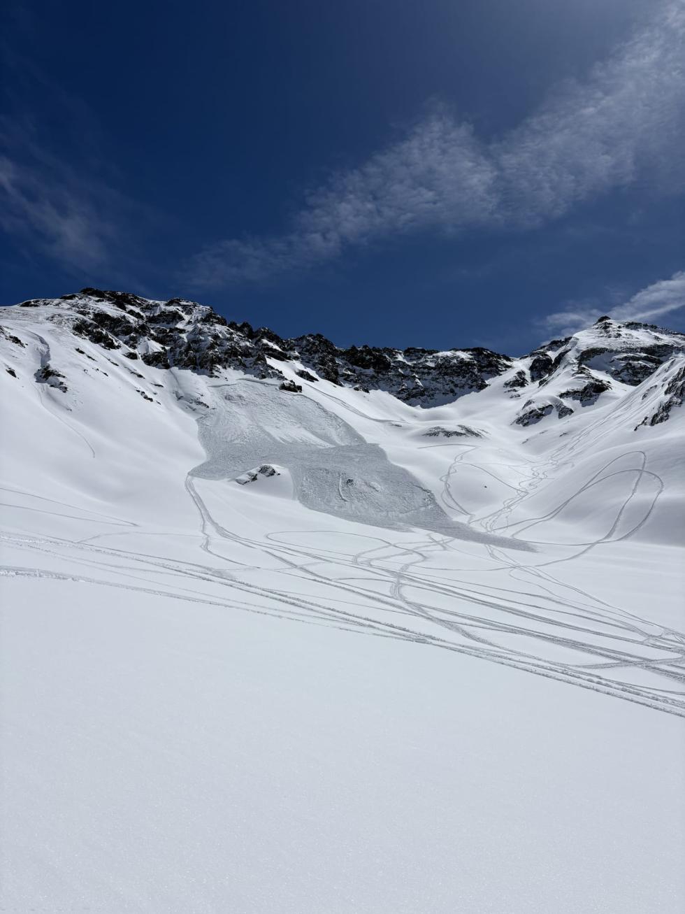
Following this storm, there was a rise in avalanche activity with 94 avalanches reported last weekend—most of them Wind Slab or Persistent Slab avalanches. In the Northern Mountains, 16 avalanches were reported last Sunday alone, including people caught in separate small avalanches. People reported 53 avalanches in the Central Mountains. Here, notable incidents included a skier remotely triggering a D2.5 avalanche on Carbon Peak and a snowmobiler intentionally triggering a large avalanche on Axtell. The Southern Mountains saw at least one large (D2) snowmobile-triggered avalanche in Minniehaha Basin.
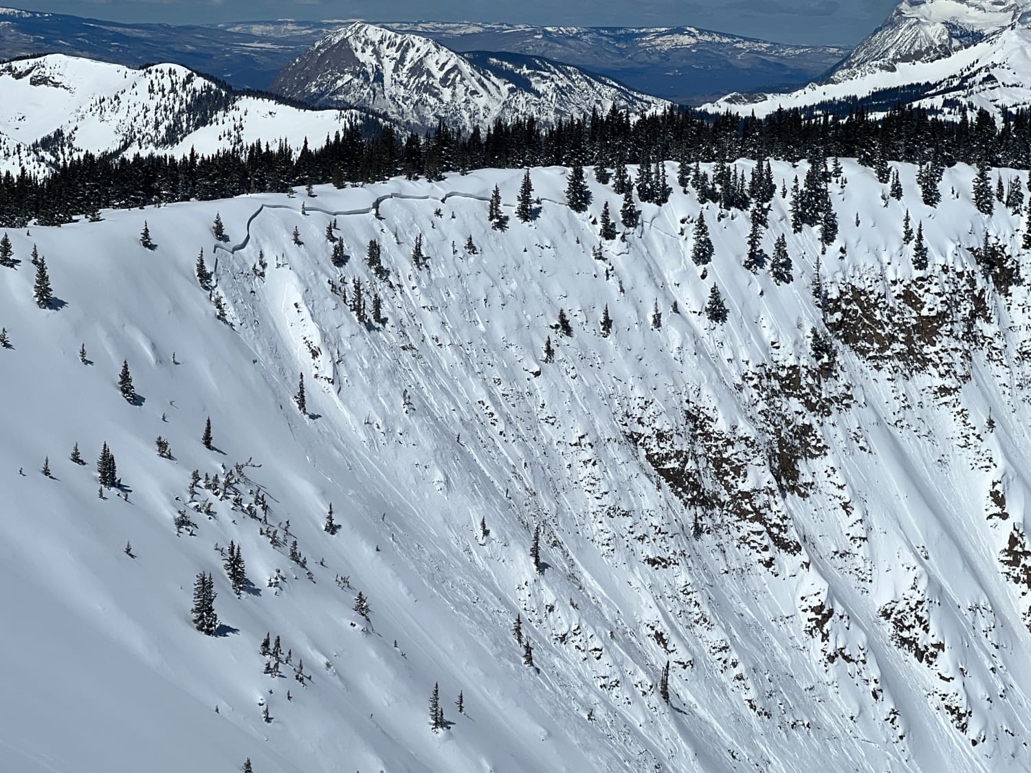
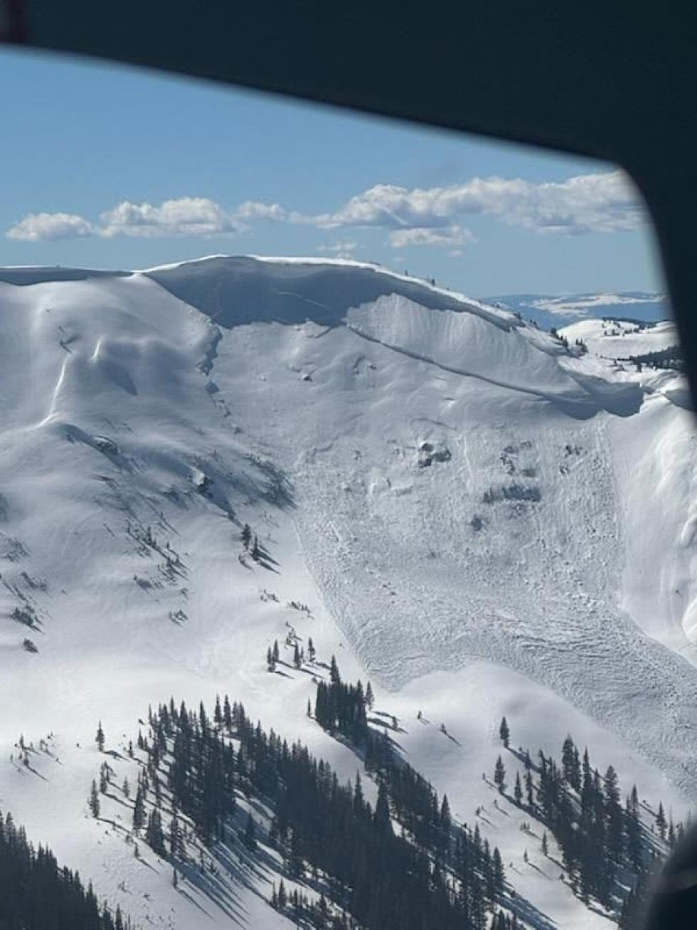
Starting Monday, a major warm-up took hold across the state. This rapid warming dramatically shifted avalanche conditions from dry avalanches to Wet Slab and Loose Wet avalanches. Each day brought warmer temperatures, peaking on Wednesday/Thursday with some unseasonably warm conditions. Over 180 avalanches were reported throughout the workweek—primarily wet avalanches. Of note, a large avalanche in the southern Gore Range on Wednesday likely failed on persistent weak layers from early March, as did a very large (D3) skier-triggered avalanche near Crested Butte.
Wet avalanche concerns will linger into Friday, especially at lower elevations, until the snowpack solidly refreezes after multiple cold nights. If forecasted cooler temperatures and light snowfall materialize, avalanche danger and wet snow problems will decrease heading into the weekend. If you find a collapsing, wet snowpack in forested or locally warmer spots, move to lower-angled terrain. We look forward to cooler temps and a more stable snowpack, but for a day or two, you’ll need to monitor the quality of the refreeze as you move through different elevations. Several inches of new snow and wind on Saturday night could create small Wind Slab problems at higher elevations.