May 2024 Summary
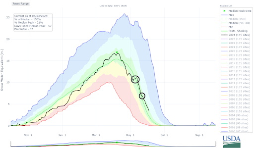
May was characterized by a decline in reported avalanches from April even as the month saw more wintry weather than usual. A prolonged unsettled period from May 6-12 pushed statewide snow water equivalent (SWE) above the 30-year median, and an additional period of unsettled weather from May 21-27 helped keep it there into June.
May saw less than half of the number of avalanches reported in April.
- 238 avalanches recorded statewide
- 49 avalanches D2 or larger
- No avalanches D3 or larger
- 46 Human-triggered avalanches
- 5 avalanche incidents
There were no fatalities in Colorado, but unfortunately, there was one in Idaho and two in Utah.
Early May Storms
May started with Wind Slab avalanches from a late April storm that drove the avalanche danger statewide. On May 5, the danger eased to LOW (Level 1 of 5) for one day before a prolonged period of unsettled weather began.
The stormy period between May 6-12 left areas in the Northern and Central Mountains with snow totals over two feet, while the Southern Mountains generally saw less than a foot. At the beginning of the storm, a powerful jet stream brought intense westerly winds. The resulting primary avalanche problem statewide was Wind Slab avalanches at upper elevations except for the Sangre de Cristo Mountains, where two feet of snow fell and Storm Sabs were the problem. Three of the five avalanche incidents in May happened on May 12. Not only were they on the same day, but all three were near Loveland Pass on wind-drifted upper-elevation slopes.
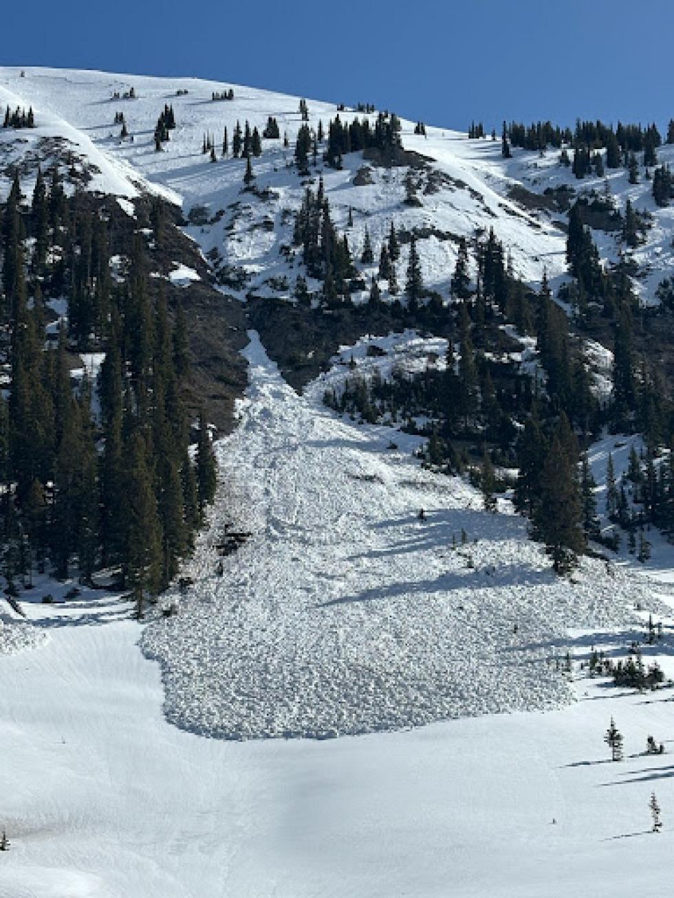
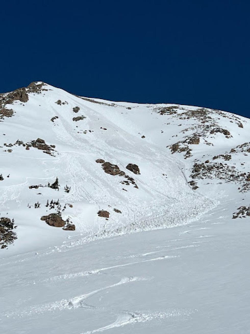
Mid-May Wet Cycle
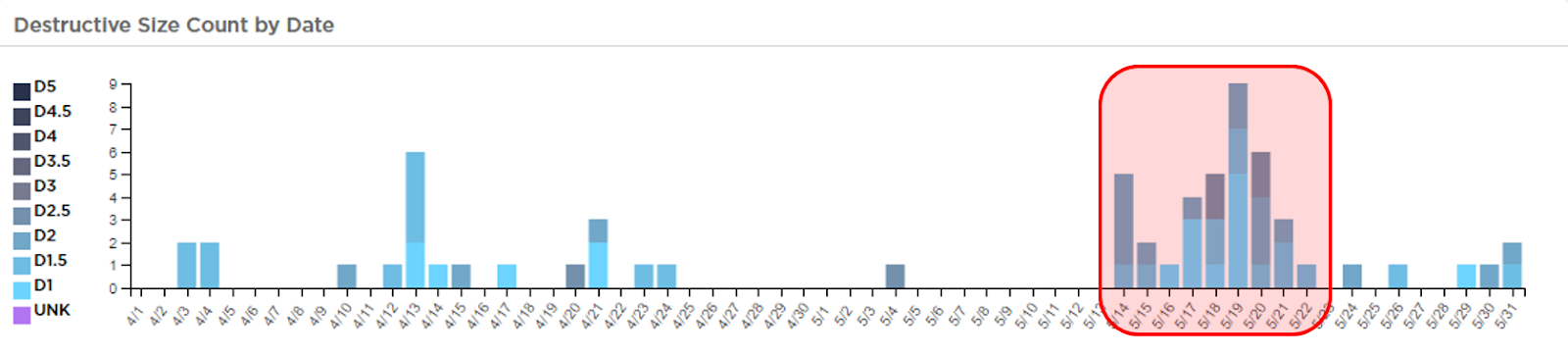
The skies finally began to clear on May 12, allowing the sun to poke out. The new snow got wet, and a Loose Wet avalanche cycle began. Over the next week, daytime highs climbed, and overnight freezes became weaker. A Wet Slab cycle started on May 14 and peaked on May 19 with 26 total Wet Slab avalanches; 10 were large enough to kill or injure a person.
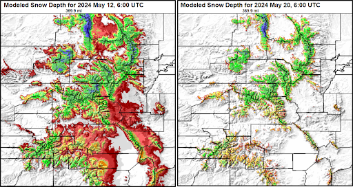
While this period was relatively less windy than the prior two weeks, strong winds continued to impact the state and likely tempered the warming of the snowpack–especially at the highest elevations. The vast majority of reported avalanches were in the Northern and Central Mountains. Due to less snow, generally warmer temperatures, and less cloud cover only three of the 138 reported slides were in the Southern Mountains. No avalanches were reported in the Southern Mountains after May 18, the danger went to LOW (Level 1 of 5) with no avalanche problems listed for the remainder of the month. Snow Telemetry sites (SNOTELs) in the Southern Mountains were all below the 30-year median and some were below 50% by May 20. For comparison, only one of the major river basins was below the 100% mark in the Northern and Central Mountains on the same date.
Late May Storms
Two final pulses of winter brought snow back to the mountains. The first pulse on May 21-22 brought some snow and cooling temperatures, although reports of wet snow avalanches continued to trickle in. Another round of snow over Memorial Day Weekend (May 25-27) came with below-freezing temperatures and slowed the Wet Slab avalanche cycle. Wind Slab avalanches returned to the Northern and Central Mountains forecasts during this time – though 41 of the 51 avalanches during this period involved wet snow.
The new snow from Memorial Day Weekend sliding off of steep slopes as Loose Wet or Wet Slab avalanches remained the primary avalanche hazard for the last few days of May. Ten avalanches were reported during this time in the Northern and Central Mountains. As this snow continued to bake down and bond to the crusts below, the danger dropped to LOW (Level 1 of 5) statewide on May 31.
June
As we head into June, small wet avalanches and cornice falls are still a concern. Small avalanches in steep or exposed terrain can be deadly. Take care if you plan on traveling above rocks, cliffs, or deep gullies. If you’re sinking past your ankles in wet, cohesionless snow, avoid steep slopes. Where you find supportable travel on thick crusts above a well-drained snowpack, you’re likely safe from avalanches.
As temperatures continue to rise and the snowpack continues to melt, cornice fall will remain a hazard. These large masses of dense snow can break well back from the edge of the ridgeline. They can also be the trigger for an avalanche. If you are traveling below them and they break, they can easily injure or kill you. If you plan on traveling on snow in or near avalanche terrain, start and end your day early. Remember, you can trigger avalanches any time of year, regardless of what the calendar says. If the ingredients are there - a trigger, a steep slope, and unstable snow - avalanches can happen.